
Rezatec - Geospatial AI for Pipeline Risk Monitoring
Focus investment on the top 20% of risks for greatest impact. Use Pipeline Risk to identify highest risk pipeline sections and focus upgrade resources on what matters. Zero-in on what matters: Pipeline Risk enables water leaders to remotely determine the highest risk of pipeline failure across the entire network - and upgrade it - ahead of time. It establishes the likelihood, consequence and cost of failure using satellite and multiple data feeds fused with the most advanced AI on the market. And it’s 10% more accurate than other risk models. Use these constantly refreshed insights to prioritize, plan and optimize investment, drive productivity gains and maximize water value.
Operations
- Focus on 20% of risks
- Tackle highest risk failure areas
- Proactively renew network
- Drive large-scale efficiencies
Engineering
- Identify potential failure
- Track evolving issues
- Prioritise engineer deployment
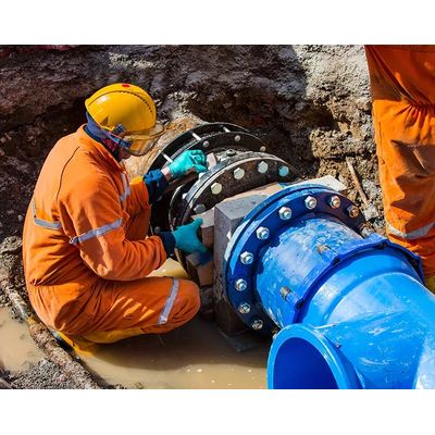
- Fix leaks faster
Leadership
- Optimise CapEx & OpEx
- Cut non-targeted upgrade costs
- Reduce leakage & non-revenue water
- Assess cost & risk of aging infrastructure
Managing networks worldwide, this business uses our geospatial AI to determine 5x the number of pipeline failures, cut maintenance and capital upgrade costs, and decrease non-revenue water.
Build a full risk profile
- Views entire network & deterioration points
- Assesses risk of failure
- Tracks changing probability of failure
Mitigate Risk & Reduce Cost
- Scrutinizes proximity to other assets
- Analyzes consequence of failure
- Quantifies likelihood of failure
- Determines most critical areas
Focus on top 20% of risks
- Identify up to 64% of leaks*
- Prioritise engineer deployment
- Optimise ground resources
- Proactively repair and upgrade
*based on customer deployment