

- Home
- Companies
- Planet Labs PBC.
- Software
- PlanetLabs - High-Resolution Imagery ...
PlanetLabs - High-Resolution Imagery Software with Planet Satellite Tasking
Planet Tasking offers high-resolution, real-time satellite imagery with an impressive 50 cm spatial resolution, enabling organizations to effectively identify blind spots, predict events, and make confident, mission-critical decisions. With around 18 SkySats in orbit, Planet's satellite constellation achieves the highest intraday revisit rates in the commercial sector, capturing actionable insights up to 5-7 times daily. This capability is crucial for sectors such as defense, civil government, forestry, emergency response, and energy infrastructure. Planet's automated Tasking Dashboard simplifies the tasking process, allowing users to autonomously submit, modify, and manage satellite imagery requests. High-resolution data is made available swiftly—within three hours of capture—and integrates seamlessly with existing workflows through Planet's API. Planet's constellation ensures a robust global coverage, capturing an average of 2,400 images per Earth landmass daily, making rapid and accurate insights accessible from anywhere.
High-Resolution Imagery with Planet Satellite Tasking
At 50 cm resolution, Planet Tasking provides organizations with real-time intelligence to proactively identify blind spots, anticipate events, and have confidence in the next mission-critical decision.
With ~18 SkySats in orbit, Planet offers the most frequent, intraday revisit capability of any commercial provider, capturing actionable insights between 5-7 times per day for real-time decision making.
Rapid Revisit :
Multiple revisits per day, the highest frequency commercially available
High Resolution
Enhanced 50 cm ortho spatial resolution images
Tip and Cue
Leverage Planet’s Monitoring and Tasking constellations for a simple Tip and Cue workflow
Global Coverage
An average of 2,400 images of every spot on earth’s landmass
Rapid Delivery
High-resolution images and insight delivered less than three hours from capture
Workflow Integration
Access data and imagery within existing workflow with Planet’s API
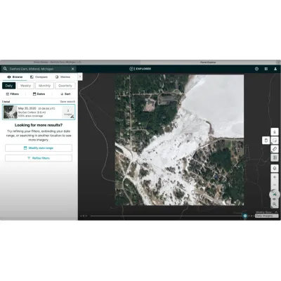
With Planet’s automated Tasking Dashboard, you can request high-frequency, high-resolution satellite imagery and data, stereo collection for 3D models and DEM construction, off-nadir imagery, and videos of any location in the world.
With the Highest Revisit Commercially Available, Planet Tasking Delivers High-Precision Insights and a Global Perspective
Planet Tasking is built for flexibility and frequency. Using the world’s most agile constellation of high-resolution Earth imaging satellites, Planet is empowering organizations with geospatial insights and images multiple times a day.
High Accuracy
Images provide extremely detailed information in high resolution
More Timely
High intraday revisit enables real-time intelligence to changes as they evolve
Easily Accessible
Cloud-based dashboard makes Tasking simple and possible anywhere
Comprehensive Library
Access to Planet’s constantly updated archive of approximately 50 PB of Earth data
With ~18 high-resolution satellites in orbit, Planet Tasking has the highest intraday revisit capability of any commercial provider globally, capturing satellite imagery and insights up to 5-7 times a day in areas that are traditionally challenging for imaging due to low satellite capacity.
High-frequency satellite imagery provides reliable, real-time information to avoid blind spots, anticipate events, and empower rapid, informed action. Planet data makes global change visible and accessible. Planet Tasking’s automated, cloud-based system ensures that your response is always timely.
Defense and Intelligence
Reliable, up-to-date satellite imagery from Planet Tasking provides fast and accessible insights into geopolitical and security events as they unfold.
- Task collections of 50 centimeter ortho imagery sub-daily
- Reduce risk and receive quick insights with tip and cue capabilities
- Capture unexpected events across remote locations, borders, and coastlines
- Extract insights with near-infrared, stereo, and video capabilities
- Validate actions with rapid revisit tasking
Protect public lands, measure policy impacts, focus on specific areas of interest, and enable rapid decision making.
- Manage and monitor infrastructure projects broadly
- Improve protection of natural resources and people
- Analyze areas of interest and derive timely insights
- Update maps and charts with the most recent data
- Monitor and detect changes to land use
Monitor and manage forest assets and operations, track changes in land use and land cover, and localize forest clearing in near-real time with high-cadence, high resolution imagery.
- Optimize your timber harvest operations
- Monitor and manage forest health
- Track changes to land cover and land use over time
- Prevent illegal and unpermitted clearing of forest
Discover how Southern Forestry Consultants utilize Planet’s real-time imagery to provide an alternative to file-based workflows, while supporting increased operational value across the sustainable forestry chain.
Accessible, frequent, and high-resolution imaging helps anticipate, assess, and mitigate disasters.
- Anticipate changes in landscape, identify potential dangers, and stem problems
- Understand the scope of disaster at speed with before and after imagery
- Inform the most effective and rapid mode of response
Fast, reliable, high-resolution data help monitor infrastructure development and growth across regions.
- Monitor important assets and reclamation projects
- Manage and preempt risks to your business
- Evaluate competitor activity, production methods, and equipment
- Mitigate and prevent crisis