

Civica Infrastructure Inc.
- Home
- Companies
- Civica Infrastructure Inc.
- Software
- Civica - Version DataCurrent - Host and ...
Civica - Version DataCurrent -Host and Analyze Flow Data
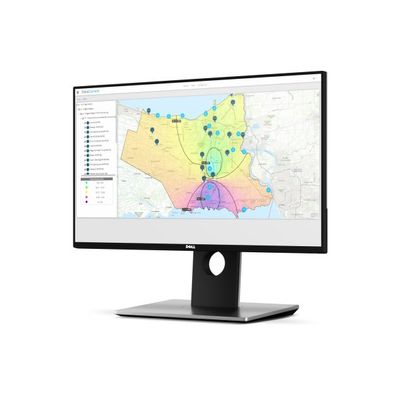
DataCurrent is a comprehensive, SaaS application designed to help identify, quantify, and address the challenges of Inflow and Infiltration (I/I). This easy to use, ESRI-based solution provides up-to-date analysis regarding the flow rates and capacities within your existing sanitary sewer network. Its 24/7, secured online access allows you to consolidate and analyze both historical and real-time sewer flow and rainfall data.
Most popular related searches
rainfall data
rain gauging
forensic analysis
field inspection
sanitary sewer
hydrological monitoring system
inspection data
sewer flow
rainfall modeling
hydrological modeling
- ANALYZE & REMEDIATE: Analyze flow monitoring data, rainfall data, and system I&I responses to explain causes of flooding and aid in the development of remediation measures;
- NEAR REAL-TIME MONITORING & ALARMING: Rain guages are used to measure and monitor rain in near-real time. An alarming system is utilized to alert municipal managers of flooding and sewer overflow potential;
- DISTRIBUTED RAINFALL MODELLING TECHNIQUE (DRMT): Monitors and analyzes rainfall in various locations to assess non-monitored locations;
- IMPROVED RAINFALL COVERAGE MAPS: Analysis of rainfall radar data in combination with rain gauge rainfall data can be viewed on a coverage map
- COMPLETE DATA INCORPORATION: Host historical, real-time, monitored, asset condition, time-series, and field inspection data. As well as as-built drawings, shapefiles/geodatabase, CSV, Excel, PDF, and video;
- INTENSITY-DURATION-FREQUENCY ANALYSIS (IDF): Compare observed rainfall events to the appropriate design IDF curves and define return rain periods (Forensic Analysis)
- Optimize the capacity of your existing network to accommodate future growth;
- Access, consolidate, and analyze your historical data;
- Secure web-based, 24/7 access;
- Alarming system;
- Analysis and reporting tools;
- Integrate to the hydrological model, Visual OTTHYMO.