- Home
- Companies
- Guideline Geo
- Software
- MALÅ - Roadway Mapper Software
MALÅ - Roadway Mapper Software
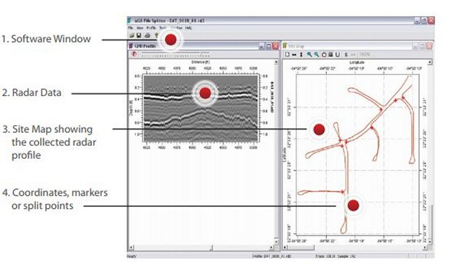
The MALÅ Roadway Mapper software allows the user to define points of reference, based on GPS positioning, for selecting sections of road that are of specific interest for post-processing based on data already collected with the MALÅ ProEx RoadCart system.
The points of reference can be either placed in the field while actually collecting the data, chosen by the user by utilizing the graphic interface or by typing in the desired GPS coordinates in manually.
The MALÅ Roadway Mapper software includes features such as a GPS site map, visualization of the collected radar profile, and corresponding location on the site map, and filtering of the radar data.
No matter what the desired method for dividing the files, the MALÅ Roadway Mapper software offers an easy to use approach for managing longer GPR profiles acquired with a GPS in a cost-effective way.