

- Home
- Companies
- Bentley Systems, Incorporated
- Software
- OpenFlows FLOOD - Integrated Flood ...


OpenFlows FLOOD - Integrated Flood Modeling Software
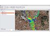
Analyze flood inundation areas and flood hazard
Easily calculate the extent of flooded areas and estimate the flood hazard based on water column heights and peak flow velocities.
Build and manage hydraulic models
Jumpstart the model-building process and manage your model effectively so that you can focus on making the best engineering decisions. Leverage and import many well known external data formats, which maximizes ROI on geospatial and engineering data and automates input data generation.
Produce visually appealing animations
Explore and present your model results using a wide range of integrated visualization capabilities, including the option to make smooth, continuous animations of the obtained results.
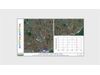
Set up scenario management
OpenFlows FLOOD allows you to create new scenarios and make comparisons among different alternatives. This allows you to rapidly find the best solution for flood risk mitigation.
Simulate river flows
OpenFlows FLOOD allows you to calculate river flow using kinematic, dynamic, and diffusion wave approaches. It simulates the exchange of water between the river flow and (sub)surface flow based on hydraulic gradients and contains capabilities to estimate the drainage network from topographic maps and to interpolate cross sections in space.
Simulate surface runoff
MOHID Land offers different methods to route surface runoff, including kinematic, dynamic, and diffusion wave approaches, using a fully distributed 2D grid with an optional 1D grid. Water from surface runoff can infiltrate, enter into a river, or evaporate. OpenFlows FLOOD contains capabilities to prepare spatial data required to calculate surface runoff. For example, the application estimates Manning’s coefficients from land use maps.
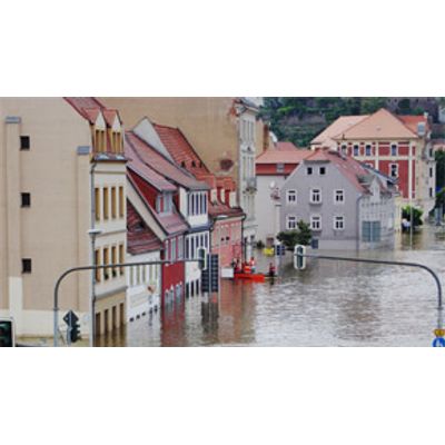
Simulate urban floods
OpenFlows FLOOD allows you to simulate flooding in urban areas by connecting the overland module to a SewerGEMS model. It simulates the exchange of water between the pipe flow and surface flow based on hydraulic gradients through inlets and manholes.
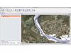
Work in a visual rich environment
OpenFlows FLOOD has an integrated GIS engine that allows you to open, edit, and visualize all kinds of data files that the model needs. Layers can be styled in multiple ways.