

- Home
- Companies
- Bentley Systems, Incorporated
- Software
- OpenSite Siteops - Conceptual Civil ...
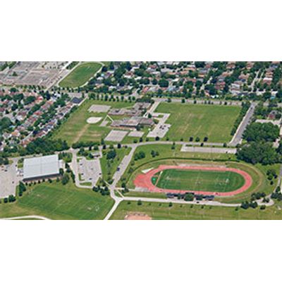
OpenSite Siteops - Conceptual Civil Site Design Software
Bentley’s SITEOPS proven software as a service (SaaS) enables you to create numerous conceptual site designs in a fraction of the time by helping you evaluate more information in the early stages of your project, design more efficiently, and minimize your land development costs.
- Instantly import the latest imagery and topographic data accessible from USGS and other sources.
- Quickly create, revise, and optimize site design layouts.
- Auto-generate a preliminary grading budget.
- Build dynamic 3D models while you work in 2D.
- Input CAD or surface files and receive outputs compatible with Bentley, Civil 3D, SketchUp, and Google Earth products.
- Deliver valuable engineering information to your client faster on any land development project.
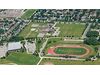
Develop site designs
Quickly create, revise, and optimize multiple design scenarios for commercial, industrial, and campus projects to determine optimal site plans for each project. Create parking lots, streets, sidewalks, buildings pads, and other design features with auto-drawing capabilities.
Generate grading and stormwater drainage plans
Quickly create, revise, and optimize conceptual layouts with grading and stormwater drainage plans while viewing associated costs. Generate cut and fill estimates on the fly. Save time and money while reducing project risks with the ability to generate fully cost-optimized conceptual site plans and takeoff budgets in minutes.
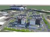
Integrate multidiscipline models in site designs
Ensure models represent all project information by incorporating site designs, drainage, driveways, buildings, and other site features. Import models to readily view the model holistically in the proposed environment.
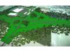
Incorporate topography and aerial imagery
Jump-start the conceptual design process by importing imagery and topographic data from USGS to view the design in a real-world setting. Drape imagery on TIN surfaces for quick 3D surface visualization. You can readily view the site’s capabilities in any location to gain insight in the design.
Model and analyze terrain
Create intelligent models containing not only terrain data but also roadway or site features. You can use features to visually distinguish structure, appearance, and symbology in the design.
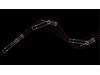
Simulate vehicle path movement
Reduce costly design errors by simulating vehicle path movement throughout the site design process to readily identify issues early in the project. Use a pre-populated library of vehicle templates or design custom templates to meet your project needs. You can export files in DWG, Land XML, and PDF formats.