

- Home
- Companies
- Lakes Environmental Software
- Software
- Lakes Environmental - Version CALPUFF ...
Lakes Environmental - Version CALPUFF View 11.0 -Puff Air Dispersion Modeling Software
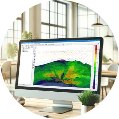
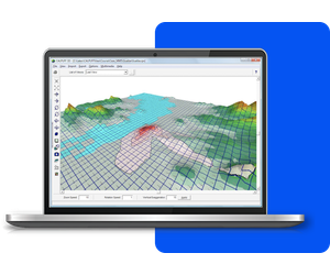
CALPUFF View provides a complete graphical solution for the CALPUFF modeling system: CALPUFF, CALMET, CALPOST, and their related pre- and post-processors. All three modeling systems are supported by the interface:
CALPUFF View is impeccably designed to streamline all aspects of model setup, execution, and analysis. Air dispersion modeling has never been easier.
Utilize multiple cores when running the CALMET model to generate model data faster than ever.
Export your buildings, sources, receptors and contours into Google Earth.
Automatically download and import high-resolution satellite and street map imagery into your projects.
Easily see where your puff will impact. The play feature shows how your puff disperses over time.
Allows you to play and record plume animations along with your wind field.
Advanced terrain processing capabilities are offered for several terrain data file formats.
We’re here to make things easy! Here’s a list of everything included with your software purchase:
- 1 Year Access to Maintenance/Technical Support
- 1 Year Access to Software Updates
- Automatic Download of Tile Maps
- Automatic Download of NED Terrain Data
- User`s Guides and Manuals
- Software Updates
- Technical Support
- Automatic Download of Tile Maps
- Automatic Download of NED Terrain Data
- User`s Guides and Manuals
CALPUFF View is an interface for Lakes Environmental’s CALPUFF modeling system. See below the technical specifications for this model:
- Model Name: CALPUFF
- Model Type: Non-steady state Gaussian Puff model
- Range: 200-300km from the source
- Time Step: 1-hour (Version 5.8), Variable down to the second (Version 6 & Version 7)
- Terrain: Elevated, processed by TERREL
- Building Downwash: Modeled by BPIP or BPIP-PRIME
- Source Types: Point, area, volume, line, flare (V7 only), road (V7 only)
- Meteorology: Hourly surface, upper air and precipitation data and/or prognostic data (e.g. MM5 or WRF)
- Wind Field: Three dimensional
- Release Types: Buoyant or neutrally buoyant plumes
- Emission Types: Constant or time-varying, planned or fugitive
- Atmospheric Chemistry: MESOPUFF II, RIVAD/ARM3, SOA, Radiological decay, ISORROPIA, and user-specified transformation rates