

- Home
- Companies
- Planet Labs PBC.
- Software
- PlanetLabs - Real-Time Satellite ...
PlanetLabs - Real-Time Satellite Monitoring Spftware
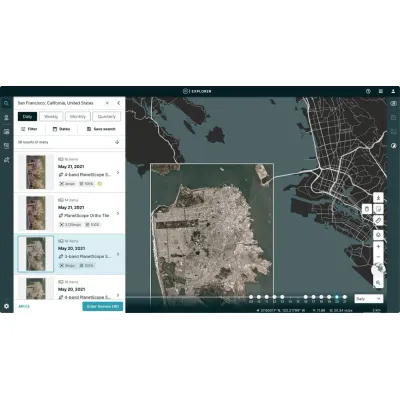
Planet Monitoring leverages a constellation of approximately 200 Dove satellites to deliver high-resolution, continuous and comprehensive global imaging. These satellites, orbiting the Earth every 90 minutes, capture detailed images at a 3.7-meter resolution across four multispectral bands: RGB and Near Infrared, which are invaluable for a variety of applications. The service includes an extensive archive dating back to 2009, capturing over 300 million square kilometers of imagery daily. This persistent monitoring allows for real-time observational capabilities, essential for timely and informed decision-making across various sectors such as agriculture, government, energy, and forestry. By providing pre-processed, analysis-ready imagery through user-friendly Planet APIs, web applications, and GIS integrations, Planet Monitoring seamlessly supports existing workflows. The subscription-based access model ensures scalability and adaptability to diverse needs, from identifying deforestation patterns in Brazil to monitoring oil exploration in remote desert areas. This robust data service empowers organizations to manage assets, track changes, and obtain ground-truth data for enhanced governance and operational efficiency.
Global Perspective, Daily Insight, and Real-time Analysis with Planet’s Satellite Monitoring
With Planet Monitoring observe areas of geographic interest, discover patterns, track infrastructure, and identify changes as they happen. From space, Planet Monitoring equips you with ground-truth data you need to make timely, informed decisions.
High Resolution
3.7 meter resolution images in four multispectral bands: RGB and Near Infrared
Image Library
Extensive archive of high-resolution images dating from 2009
Global Coverage
Over 300 million square kilometers of imagery collected each day
Access and Integration
Ready-to-use images and data, integrated simply into your existing workflow
Planet Monitoring provides 3.7 meter resolution images of the entire Earth daily. Access to these ready-to-use images is made simple with Planet’s APIs, web application, and GIS integrations. Available through a subscription model, Planet Monitoring can be scaled to the requirements of your analysis and application needs.
Planet Monitoring provides a persistent view of land, assets, and operations, from anywhere on earth.
Greater Visibility
Obtain ground-truth data from opaque, dispersed, or remote geographies
More Timely
Roughly 200 Doves orbit the planet every 90 minutes, providing near real-time images for time-sensitive monitoring
Continuous Coverage
The PlanetScope Constellation is always on, ensuring constant coverage
Evolution by Design
Improved on-orbit capacity with multiple launches of updated Dove satellites each year
Access and Integration
Ready-to-use images and data, integrated simply into your existing workflow
Planet Monitoring delivers up-to-date insights and satellite images from the areas that matter to you, on a daily basis. With Planet’s growing visual archive, analyze deep stacks of imagery from 2009 until today. Leverage Planet’s global coverage to observe areas of strategic importance at a local, national, and international level. Survey broad areas at scale to identify changes and make timely interventions.
Agriculture
Reliable, up-to-date satellite imagery from Planet Monitoring provides simple and accessible agricultural insights at scale.
- Farm more efficiently, profitably, and sustainably with continuous field coverage
- Gain agronomic insight through field-level detail
- Monitor and analyze field and crop health from preseason to harvest
Ag-Tech companies and farmers alike are looking to new technologies to ensure bountiful crops. Read about how Granular employs Planet Monitoring over more than 22 million acres to drive more efficient, profitable farming through anomaly detection, directed scouting, and automated agronomic advice.
Government
Oversee infrastructure, monitor natural resources, and protect communities from risks using Planet’s continuous monitoring service.
- Manage and monitor infrastructure projects across large landmasses
- Improve protection of natural resources and people
- Analyze geographic areas of interest and derive timely insights
- Monitor and detect illegal changes to land use
Government bodies are using Planet data to address critical governance challenges. Learn about how the New Mexico State Land Office used Planet Monitoring to uncover 53 trespasses which yielded $2.7 million in back payments.
Energy and Infrastructure
Reliable, up-to-date satellite imagery with Planet Monitoring provides fast, accessible insights on energy assets and production.
- Monitor your assets in their entirety, remotely
- Manage and preempt risks to your business
- Evaluate competitor activity, production methods, and equipment
- Mitigate and prevent crisis
In a remote corner of the Libyan Desert, almost 100 miles from any known oil reserves, Planet uncovered oil exploration using a combination of high cadence monitoring and satellite tasking.
Forestry
Monitor and manage forest assets and operations, track changes in land use and land cover, and localize forest clearing in near-real time with high cadence, high resolution imagery.
- Optimize your timber harvest operations
- Monitor and manage forest health
- Track changes to land cover and land use over time
- Prevent illegal and unpermitted clearing of forest
Learn how Pan Pac automated the collection and reporting on harvested areas by using high frequency, 3.7 meter PlanetScope imagery. This resulted in significant time and cost savings for their team, streamlined workflows for end of month and year-end reporting, and improved data accuracy.
With a Planet Monitoring subscription, you have easy access to the most up-to-date images of your area of interest and an expansive archive.
Planet Monitoring’s global image dataset is updated daily, and dates back to 2009. Delivered in ready-to-use formats, these images are easy to access and order through Planet’s APIs, web applications, and GIS integrations.