

- Home
- Companies
- SuperGeo Technologies
- Software
- SuperGIS - Version SuperSurv 10 - ...
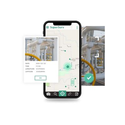
SuperGIS - Version SuperSurv 10 -Reliable GIS App for Mobile Devices
Download SuperSurv and experience it in 10-minute intervals at no cost. To get a trial code and fully experience the software at no cost within 7 days, please send us an email with your name, organization, and how do you know us.
PACKING LAYERS INTO LAYERSET FOR EASY MANAGEMENT
Layerset is a leading-edge design which allows the team leader to set up the target attributes before fieldwork. The fieldworkers only need to import the appointed Layerset for outdoor survey before they head off, avoiding tedious data integration afterwards.
POPULAR FORMAT AND BASEMAP ARE SUPPORTED
Mainstream basemap and format, including Google Maps, TIFF, DXF, and DWG, can be read with ease in SuperSurv 10.1. Now, users can effortlessly import their raster maps, overlay with one of the greatest basemaps, and start to collect data.
EDITING YOUR DATA MORE PRECISELY
Snapping is not the limited to desktop GIS anymore. This secret weapon helps SuperSurv 10.1 users edit features more precisely. By setting proper tolerance and identifying the right map layer, you will never miss where you want to snap to.
CUSTOMIZING YOUR COORDINATE SYSTEMS
Despite Supergeo spares no efforts to collect coordinate systems from all over the world, there are always some left behind. As a result, in SuperSurv 10.1, you can enter parameters and define your own system without spending too much time on data conversion.
MORE POWERFUL TEAM WORK FLOW
SuperSurv can easily connect to cloud by Google Drive and Dropbo x. Prox. Prox. Provide online resources likvide online resources like online map and OGC service.OGC service.
MORE APPLICATION USED BY POSITIONING
Through position service, you can collect high-accuracy track data with ease. A dashboard can record the detail of satellite information from GPS, GLONASS, Beidou, Galileo,SBAS and QZSS.
BRAND-NEW, INTUITIVE AND BIGGER INTERFACE
Nobody wants to waste too much time finding function in app. Well-designed tool management can provide bigger space for display data. The storage of icon also help user enhance the efficiency of field survey.
HIGH COMPATIBILITY OF DIFFERENT FORMAT DATA
Geospatial PDF, TIFF format, Mbtiles and online map service are all supported in SuperSurv. Various combinations make field work easier and faster.