

- Home
- Companies
- ThreeDify Inc.
- Software
- ThreeDify - Geological Modeling and ...
ThreeDify - Geological Modeling and Resource Estimation Software
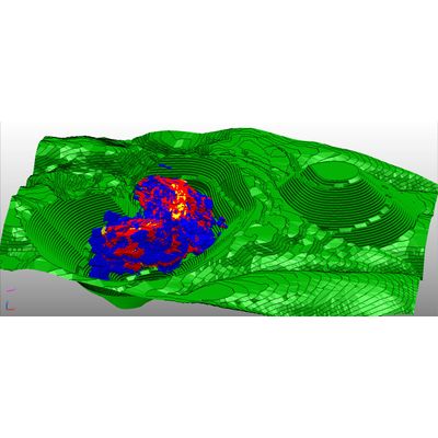
GeoMine GeoModeler (GeoModeler), the mining and exploration industry’s high-performance 3D geological software tool for resource modeling and estimation, is engineered to model and visualize large and complex deposits. Underpinning GeoModeler is its innovative 2-in-1 hybrid modeling kernel that supports both 3D Block Modeling with Sub-blocking and 2D Gridded Seam Modeling (GSM) schemes (note that the GSM module requires a separate license). Expanding on GeoMine’s legacy of supporting a big block model universe (2^19 x 2^19 x 2^19), GeoMine 6.5.x now boasts a 2^40 x 2^40 x 2^40 block model universe, an astronomical size that is unheard of up until now.
DrillHole Submodule
Imports assays, attributes (categorical or continuous) and geological structures, including faults; Desurveys drillholes with choices of 5 Desurvey algorithms; Composites and color-codes drillholes by lithology, attributes or assays; Creates custom DDH attributes as input to subsequent block model interpolations; Creates planned drillholes for drilling planning.
Option to filter or merge composites with a user defined formula.
3D Block Modeling with Sub-Blocking
Models vein or seam type deposits with non-axis aligned Mine North and non-axis aligned block models; model large deposits with a huge block model universe (2^40 x 2^40 x 2^40); Models disseminated multi-orebody deposits with multiple block models in a single GeoModeler session; Creates block model masks for open-pit deposits; Creates and assigns user-defined attributes to block models with a visual formula/scripting editor; Manually assigns rock code to parts of a block model using a solid mesh; Includes integrated Block Model Reconciliation.
2D Gridded Seam Modeling (requires a GSM Modeler license)
Creates Gridded Seam Models (GSMs) from drillholes; Resource estimation for GSMs; Performs Margin Ranking on GSMs; Converts GSMs to Block Models for Lerchs- Grossmann pit optimization for deeply inclined multi-seam GSMs.
Implicit Modeling
Automatically creates lithology wireframes; Creates real-time grade shells to evaluate what-if scenarios quickly.
3D Variogram Modeling
Models anisotropy with 3D per-mesh variograms and non-axis aligned ellipsoidal search radii.
Automatic batch mode experimental variogram generation using CPU or GPU to find the best variograms to use among thousands of possible choices.
Option to auto-fit theoretical variograms to experimental variograms.
Fault Network Modeling
Creates normal faults, reverse faults, strike-slip faults or combinations of the above fault types; Creates and manages fault networks with finite or infinite faults; Uses fault networks for unfaulted interpolation of faulted deposits.
Interpolation Submodule
Interpolates block model grades with high-performance Inverse Distance Power, Anisotropic RBF (Radial Basis Functions), Nearest Neighbor and multi-threaded Kriging methods (simple, ordinary and SGS, i.e., Sequential Gaussian Simulation) with or without geological domains and/or automatic normalization; Includes options to use unfaulting and dynamic anisotropy or unfolding for more accurate resource estimates.
Options to perform stochastic orebody simulations using SGS by generating multiple block model realizations of the same orebody in a single run.
Data Analysis & Block Model Validations
Automatic assay capping using decile analysis; Creates distribution bar charts and curves for drillhole lengths, assays, composites and block models; Validates block models using Histogram Comparison Plot, Q-Q & P-P plots and Swath plots.
Resource Classification and Resource Reporting
Classifies and exports estimated blocks into measured, indicated and inferred categories for public reporting;
Advanced classification and custom report generation with ThreeDify’s formula-based Block Model Report Generator. Classification criteria include any combination of Kriging Variance, DNC (Distance to Nearest Composite), MDC (Mean Distance to Closest Composites), # of nearby samples and # of nearby drill holes, etc..
Import DDHs
Imports drillholes as separate objects in CSV or Microsoft Access database format (*.mdb).
Ability to import a large number (>10000) of blast holes as a single drill hole collection object for performance.
DA or Unfolding Surface Creation
Creates Dynamic Anisotropy (DA) surfaces (either manually or automatically from a wireframe) for use in DA or Unfolded Interpolations.
Topography/Geo-Surface Submodule
Creates gridded topographical or geological surfaces from drillhole collars, categorical attributes, block models and/or an imported 2.5D mesh.
GIS Intergation
Plots drill holes and property lines on the Google or Bing map