ThreeDify Inc.
- Home
- Companies
- ThreeDify Inc.
- Software
4 software found
ThreeDify Inc. software
ThreeDify - GeoMine Foundation Module
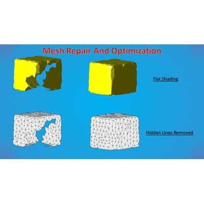
The GeoMine Foundation Module is an integral component of the GeoMine software suite specifically tailored for geological modeling and mine planning. It offers a coherent workspace common across all modules, facilitating seamless data integration without the need for cumbersome import and export processes. This efficiency boost is due to its non-blocking, event-driven user interface. Comprehensive CAD tools augment this workspace, enabling users to efficiently manage block models, coordinate systems, and attributes. Additionally, it supports advanced features like block modeling with sub-blocking, attribute management, and wireframing. It can process extensive data, handling up to 2^40 blocks in a single universe, and supports numerous file formats for import and export, including generic 3D and GIS formats. The module also includes tools for creating custom reports, executing Boolean operations on models, and conducting solid and surface modeling. GeoMine is ideal for professionals seeking an integrated, versatile, and efficient mining software solution.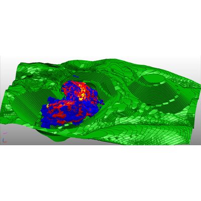
ThreeDify - Geological Modeling and Resource Estimation Software
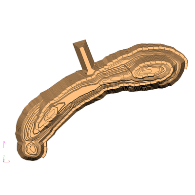
GeoMine GeoModeler (GeoModeler), the mining and exploration industry’s high-performance 3D geological software tool for resource modeling and estimation, is engineered to model and visualize large and complex deposits. Underpinning GeoModeler is its innovative 2-in-1 hybrid modeling kernel that supports both 3D Block Modeling with Sub-blocking and 2D Gridded Seam Modeling (GSM) schemes (note that the GSM module requires a separate license). Expanding on GeoMine’s legacy of supporting a big block model universe (2^19 x 2^19 x 2^19), GeoMine 6.5.x now boasts a 2^40 x 2^40 x 2^40 block model universe, an astronomical size that is unheard of up until now.
ThreeDify - OreChaser: Drillhole Planning and Optimization Software
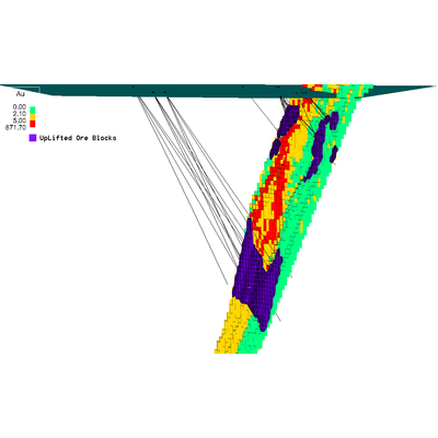
GeoMine-OreChaser by ThreeDify Inc. is an advanced software tool designed for drillhole planning, optimization, and evaluation in both open-pit and underground mining operations. The system allows geologists and drill planners to create and optimize drillhole plans both manually and automatically. The OreChaser Planner offers tools for creating planned drillholes manually in cross-sections or in 3D, as well as batch creation of gridded drillholes subject to topographical or polygonal constraints. The software's optimizer employs machine learning and a proprietary 3D Genetic Algorithm with two strategic options, RocDP and FRD, to enhance metal recovery while addressing Kriging variances within budgetary limits. Unlike many competitors, OreChaser optimizes both directional and non-directional drillholes that can originate from either a topographical surface or underground mine accesses, allowing for greater flexibility. Additionally, the Evaluator module aids in assessing the impact of planned drillhole additions on existing drill programs, offering essential data such as ore tonnage, metal quantity uplift, and costs.