
Version EagleView Cloud -High-Resolution, Frequent Aerial Imagery for Informed Decision-Making
Improve efficiency with remote insights for property assessment, public safety, GIS and other departments.
Inspect sites remotely from all angles for expedited project cycles.
Monitor condition changes and locations for key assets.
See pre- and post-storm imagery to quickly assess damage and resolve claims.
Identify roof obstructions and determine roof access points and material staging areas.
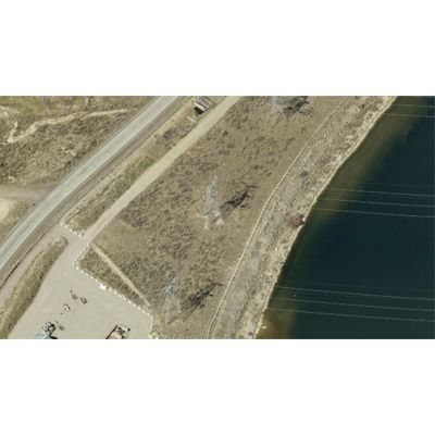
Pinpoint and mitigate vegetation encroachment risks to utility transmission lines.
See Critical Site Details with Clear Imagery
EagleView Cloud includes multiple resolution options ranging from 1-inch to 6-inch GSD, with both top-down and oblique aerial imagery to view sites from all angles. Inspect thousands of sites virtually, and reduce costly field visits and on-site verification.
Get Coverage You Can Count On
Our imagery covers 94% of the United States population, with some areas updated as often as two times per year. Our expansive image database contains more than 1 billion images, plus decades of image archives for change detection and management.
Put Property Data to Work
EagleView’s high-resolution aerial imagery underlies our gold-standard property reports and site data sets. Our powerful web-based image viewing applications and software integrations give you the tools and data you need to work efficiently and remotely without sacrificing accuracy.