Advanced Geophysical Operations and Services Inc. (AGCOS)
- Home
- Companies
- Advanced Geophysical Operations and ...
- Software
- Version ZondRes2Dp - Resistivity + IP ...
Version ZondRes2Dp -Resistivity + IP 2D Data Interpretation Software in Polygonal Way (land, borehole)
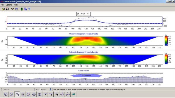
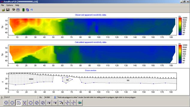
ZondRes2Dp is designed for 2D Resistivity and IP data interpretation in land and borehole version. The tasks of the program are similar to the ZondRes2D, but this program uses polygonal variant for describing geolectric medium. This approach gives some advantages for data inversion above some sort of a section. Using this approach, 2D section of any geoelectrical body is described with closed polygon.
Most popular related searches
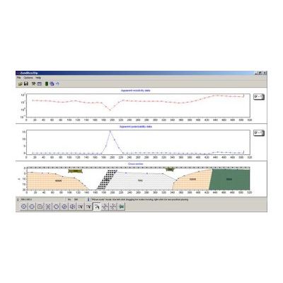
ZondRes2Dp has a possibility to model gravimagnetic fields as well. For this reason, there are 2 additional parameters: density and magnetic permeability. This feature is very useful for integrated geophysical data interpretation.