

Earthfx Incorporated
- Home
- Companies
- Earthfx Incorporated
- Software
- Viewlog - Map Editor Software
Viewlog - Map Editor Software
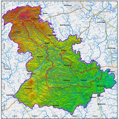
The Map Editor includes tools that combine the key features of GIS, CAD and image processing into an integrated tool for geoscientists. Key objects are managed as high-level, 3D ‘geo-objects, with integrated analysis functions.
Most popular related searches
borehole data
geological modeling
integrity monitoring
borehole
surface water level
mapping software
mapping system
surface water
These geo-objects include:
- Borehole Data Sources: borehole data is drawn from any ACCESS, Oracle or SQL database
- These data can be posted in plan view, cross section and 3D
- Parameter Data Sets: Used to manage geologic properties (i.e., layer surfaces, geologic units, water levels).
- Parameters can be posted, interpolated to a grid, edited and contoured in both plan view and cross section.
- Numerous functions are available for comparing and editing parameters.
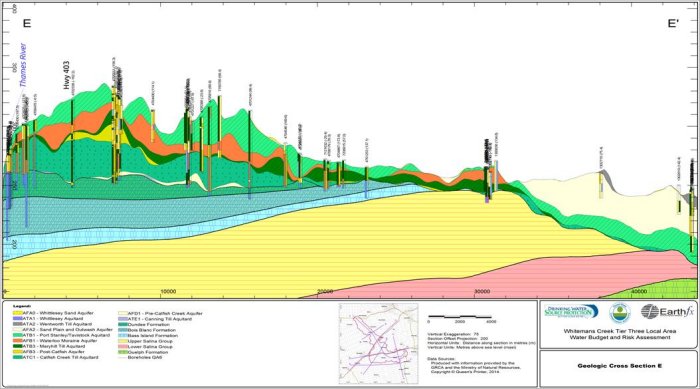
- Creating a cross section is as simple as drawing a polyline on your basemap. In cross-section view, you can dynamically shift your sections through your geologic model.
- Geologic interpretation is done by creating interactive geologic formation picks and 3D interpretation lines on section. Geologic picks are stored in a database table, and both picks and 3D polylines can be included in the interpolation process.
- Vertical exaggeration and borehole offset projection distance can be changed easily, even after interpretation. All Map Editor selection and drawing functions are available in cross section view.