

Advanced Geosciences Inc. (AGI) software
AGI EarthImager - Model 3D - Inversion Modelling Software
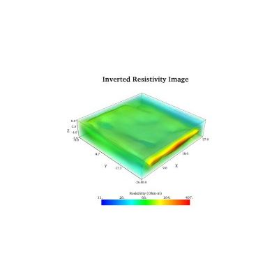
AGI EarthImager 3D is a three-dimensional resistivity and induced polarization (IP) inversion modeling software. It converts electrically gathered data and converts it into a 3D rendering presented using an advanced volume display.
AGI EarthImager - Model 2D - Inversion Modelling Software
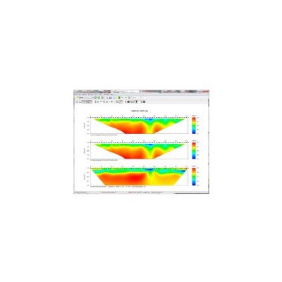
AGI EarthImager 2D is a two-dimensional inversion modeling software for affordable resistivity and induced polarization (IP) imaging. It interprets data collected by the SuperSting Wi-Fi in just a few clicks, including parallel boreholes or on a surface line.
AGI EarthImager - Model 1D - Inversion Modeling Software for Vertical Electrical Sounding
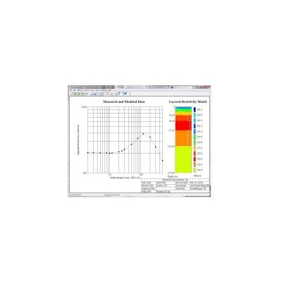
EarthImager 1D is an inversion modeling software program used to interpret one-dimensional electrical resistivity data and reveal a layered model of subsurface geology. EarthImager 1D can process vertical electrical sounding (VES) data collected with Schlumberger, Wenner, dipole-dipole, pole-pole, and various other arrays. Traditionally measured and modeled geologic data is presented in basic graphed charts that are neither simple nor intuitive. With EarthImager 1D software, you can easily and quickly calculate true resistivity.
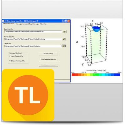
AGI EarthImager - optional Time Lapse Inversion Module
The optional Time Lapse Inversion module for EarthImager™ 2D and EarthImage™ 3D is used for in-situ monitoring applications. Our Time-Lapse Module takes a base (or baseline, background) resistivity data set to establish a reference model. Then, the survey is repeated during the monitoring period with the same command file as the one used in the base survey. Our Time Lapse Inversion algorithm uses the base survey data and resistivity model to invert the difference between the monitor and base data sets, resulting in faster convergence and greater sensitivity to small subsurface changes. This cancels out coherent inversion anomalies in the different images and focuses on the changes occurring in the subsurface over time.
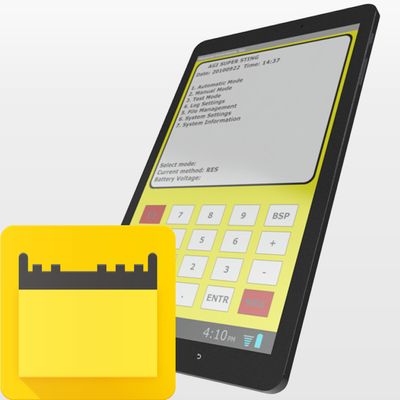
AGI SuperSting - Manager (SSM) Android App
Enjoy enhanced mobility, efficiency, and data-quality control of your SuperSting™ Wifi with the SSM App for Android. You no longer need to monitor imaging surveys from the instrument in the field. The added mobility allows you to send data immediately to your processing center from the comfort of your air-conditioned vehicle—since the app works up to 100 meters away (depending on terrain and atmospheric conditions). Using Android™ tablets or phones, you can check the electrodes for contact resistance and control the SuperSting™ at the same time. Real-time data is displayed in both numerical and color plots so that you can adjust to site conditions immediately.
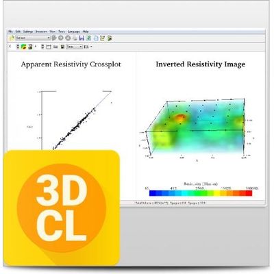
AGI EarthImager - Model 3DCL - Polarization (IP) Inversion Modeling Software
AGI EarthImager™ 3DCL is a three-dimensional resistivity and induced polarization (IP) inversion modeling software. It comes with the 32-bit basic version of EarthImager™ 3D along with the 64-bit 3DCL. 3DCL can access more than 2GB of memory space and carry out scalable parallel processing on a multi-core and/or multiprocessor PC. AGI Earthimager™ 3DCL is only available for PC’s running Windows.