

Ambiental Risk Analytics software
FloodCat - Risk Managers Precise Data Asset Software
Our FloodCat models use the latest data for the most accurate predictions. Our flexible flood cat (catastrophe) models are designed to give asset and risk managers precise data about their overall exposure in the event of a catastrophic flood. They enable you to rapidly assess portfolio-wide risk and make better decisions around capital allocation.
FloodFutures - Predictive Flood Infrastructure Managers Software
FloodFutures is our predictive flood model that considers nine possible climate change scenarios between 2020 and 2080. We developed it to help (re)insurers, utility companies, local authorities, infrastructure managers and commercial developers understand and plan for long-term flood risk.
FloodSat - Emergency Response Software
Originally developed to improve the data available to emergency response teams, FloodSat uses satellite radar imagery to give you information and insight into floods as they happen.
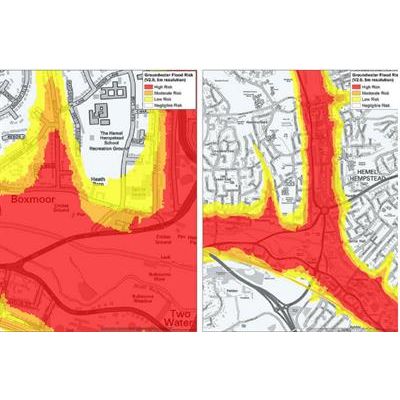
GeoSmart - Groundwater Flooding Dataset Software
Partnering with GeoSmart, we can provide the most precise groundwater flooding dataset available in Britain today. This offers insurers, developers and property asset managers an even more comprehensive overview of flood risk.
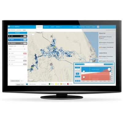
Flood Dashboard Systems
Flowroute - Model I - Flood Modelling Software
Flowroute-i is our own, proven, flood modelling software. First developed with scientists at Cambridge University in the UK, it’s an exceptionally flexible, powerful, accurate and easy-to-use modelling platform.