

DeepOcean services
Survey & Seabed Mapping
Seabed Mapping Service
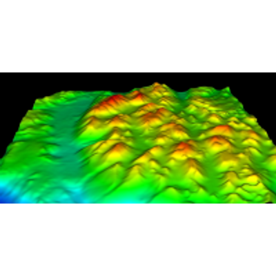
Towed Side Scan Sonar or Multibeam are predominantly used to obtain the data required to produce high quality Digital Terrain Models (DTM`s). This type of survey would be undertaken as part of a Route Survey which is necessary for the planning of pipeline installations. This type of survey enables the topography of the seafloor to be examined for wrecks, manmade artifacts, debris and other points of interest. This ensures that pipes and cables are not laid in potentially hazardous areas. The composition of the seabed can also be determined for burial and trenching evaluation.
Route Survey Service
DeepOcean will plan and deliver route surveys and seabed mapping for subsea module/rig, cable, pipeline and flexible installation and trenching projects. Using the latest survey techniques and ROV and vessel mounted equipment, the route is verified as being safe, clear of obstructions and as planned in order to ensure the work can take place without incident or interruption. DeepOcean will advise on obstructions and the potential solutions to enable the project to proceed. This advice can include understanding the limitations of the constructions, installation and trenching activities and the associated risks. This service can be provided as a standalone service but is often integrated in to the installation, construction or trenching contract and vessel.
Pipeline Survey Service
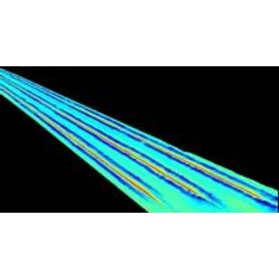
Seabed and product profiling is carried out using Dual Head Multibeam Echosounder systems. DeepOcean is a major supplier of pipeline inspection surveys for detecting free-spans, damage and defects, leaks, cathodic erosion and pipeline movement. Our survey and inspection vessels are equipped with ROVs fitted with video cameras, acoustic scanning systems, CP probes and pipe-trackers to locate buried lines and with ROTs for acoustic pipeline surveys.