- Home
- Companies
- LandScan, LLC
- Products
LandScan, LLC products
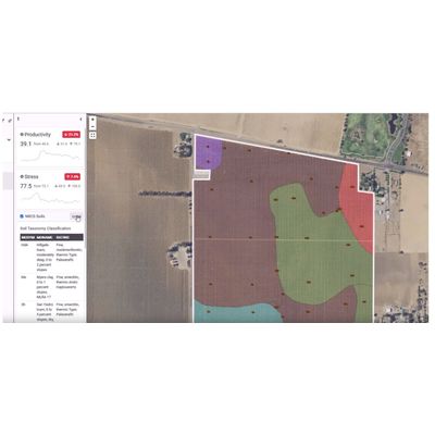
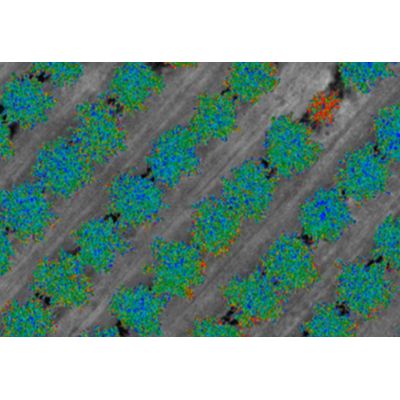
Digital Soil Map
There is a big difference between soil maps that are created in analog and subjective environments and then digitized and soil maps that are created, from start to finish, using objective, digital methods. LandScan uses the worlds most advanced sensing systems and the unique analytics that enable us to produce spatially and statistically accurate 3D digital soil maps. This accuracy is critical to the effective deployment of precision applications and technologies as well as advanced crop analytics. Humans are better at understanding information if it can be displayed in a way that is intuitive. It is not practical to display the thousands of unique and independent sensor data dimensions in 3D for human consumption. At the same time, it is not necessary to display data at all for the analytics to assess, interpret, and classify the complex relationships between site characteristics. However, we do create some of these maps to help our customers understand the information better.
Field Intelligence
Digital Vegetation Signature
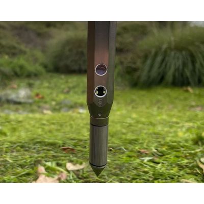
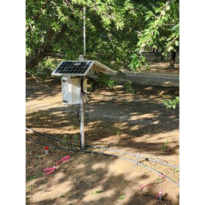
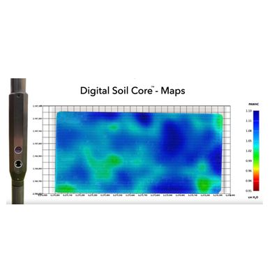
Digital Soil Core
The Digital Soil Core (DSC) is a probe with 7 independent sensors that is pushed into the ground at a continuous rate that enables the DSC to characterize the full soil profile to a depth of 120cm+ in about 1 minute. The DSC is part of the LandScan Platform for Discovery site characterization and analysis system where it is digitally synchronized with other complimentary technologies. While LandScan is focused on agricultural applications of the DSC, there are many other applications outside agriculture as well.