
NV5 Geospatial Solutions, Inc. software
NV5 ENVI - Industry Standard Image Processing and Analysis Software
ENVI is the industry standard image processing and analysis software. It is used by image analysts, GIS professionals, and scientists to make critical decisions and solve difficult problems with confidence.
NV5 ENVI Connect - Powerful Web-based Image Analysis and Processing Software
ENVI Connect, a powerful web-based image analysis and processing software, lets users quickly discover, visualize, and extract information from data as well as generate products. ENVI Connect increases and simplifies collaboration for experts and non-experts so they can more effectively tackle problems with geospatial data, extending the scientific reach across an organization.
ENVI Inform - Persistent Monitoring Software
Remotely sensed data provides many insights, but processing and analyzing large volumes of data can be time-consuming, costly, and prohibitive for those without resources or know-how. ENVI Inform is an automated monitoring service that processes and analyzes large volumes of data and delivers insights.
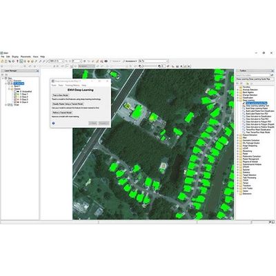
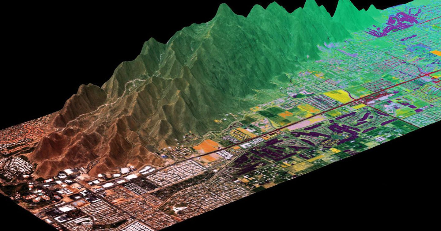
NV5 ENVI - Deep Learning Software
NV5 Geospatial has developed commercial off-the-shelf deep learning technology that is specifically designed to work with remotely sensed imagery to solve geospatial problems. The ENVI Deep Learning module removes the barriers to performing deep learning with geospatial data and is currently being used to solve problems in defense, disaster response, urban development, transportation and other industries.
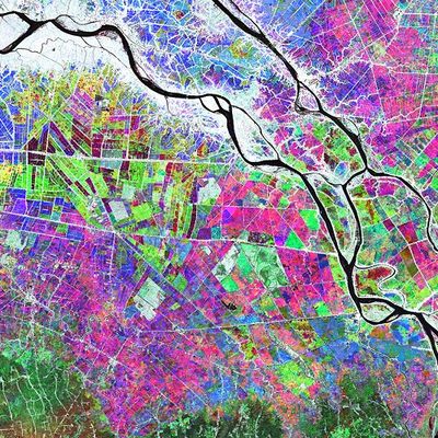
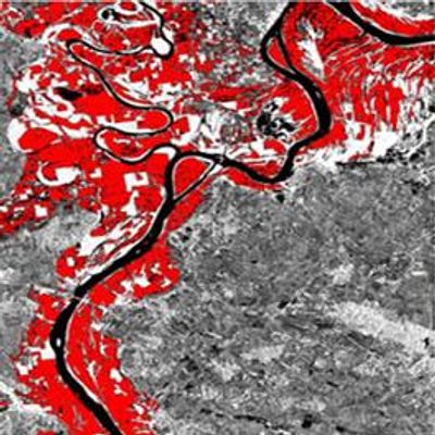
ENVI SARscape - SAR Image Analysis Software
The use of Synthetic Aperture Radar (SAR) data has become increasingly popular in recent years due to its many advantages such as its ability to capture data day or night and see through clouds. However, SAR data can be extremely complex and difficult to work with. ENVI SARscape has made the benefits of SAR data available to professionals across industries for many years. And now it's gotten even easier! ENVI SARscape now includes easy-to-use tools for some of the most common SAR processing applications -- extending the benefits of SAR data to more users. These tools, ENVI SARscape Analytics, can be accessed in the ENVI toolbox and ENVI Modeler as well as ArcGIS Pro, and do not require you to be an expert in SAR to run them!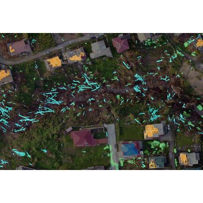
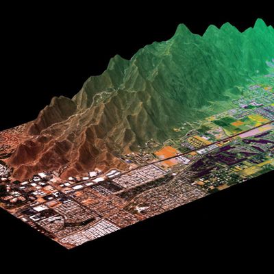
ENVI Deep Learning - Automate Analytics
L3Harris Geospatial has developed commercial off-the-shelf deep learning technology that is specifically designed to work with remotely sensed imagery to solve geospatial problems. The ENVI Deep Learning module removes the barriers to performing deep learning with geospatial data and is currently being used to solve problems in agriculture, utilities, transportation, defense and other industries.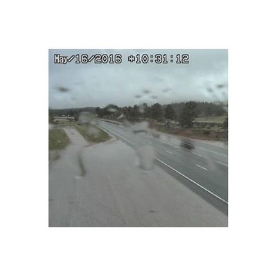
Helios - Road Conditions Analytics Software
Road Wetness Analytic: Helios Road Wetness Analytic provides confirmation of precipitation affecting road or pavement conditions and notifies users of wet or dry pavement and potentially dangerous areas during a storm event.
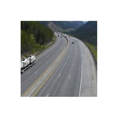
Helios - Dynamic Weather Conditions Analytics Software
Visibility Analytic: Helios Visibility Analytic alerts users of real-time fog formation, dissipation, and overall poor visibility conditions caused by fast-moving, localized fog, heavy rain, heavy snow (white-out condition), or even smoke.
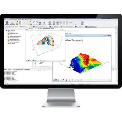
IDL - Insightful Graphical Visualizations Software
Produce insightful graphical visualizations of your complex numerical data quickly and easily with the IDL graphics system. With its intuitive syntax, the IDL graphics system gives you the flexibility to create high-quality graphic visualizations to help interpret your data and share results with colleagues.