

Pix4D SA
1 software found
Pix4D SA software
Data Capture Hardware
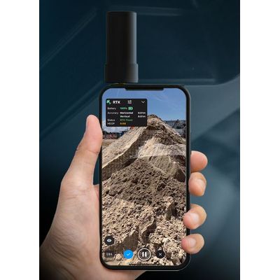
Model PIX4Dcatch RTK Workflow - Terrestrial 3D Scanning With Rtk Survey-Grade Accuracy
Use PIX4Dcatch and the viDoc RTK rover to document trenches. See how you can digitize and accurately document trenches and as-builts on construction sites. Capture: Use your smartphone with the PIX4Dcatch mobile app to capture the asset. Add an RTK device to it, to improve your accuracy. Process: Upload your images automatically to PIX4Dcloud for seamless processing OR import your images from the phone to the PIX4Dmatic desktop app, using the PIX4Dcatch processing template. Export to CAD/BIM/GIS: Mark your assets on PIX4Dsurvey as vectors in the pointcloud and export them as DXF (for CAD) or SHP (for GIS).