
TerraMath software
3D Modeling
TerraMath - 3D Interpolation Software
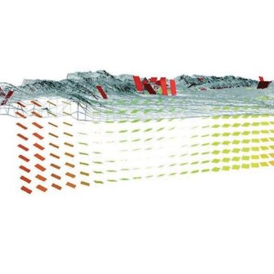
This is the next logical step after gathering all geological / geophysical data. Modeling and interpolation means that we put the data in relation to each other. Geological systems are extreme complex and at the same time well hidden underground. Our goal is to provide functions to create as realistic models as possible. Geometric smooth models might look impressing and beautiful but often lack detail (except geometry) which are essential for the later application. We prefer to use VOXEL based approaches which are extended to store all relevant data for each location and not only at the volume surface. These 3D models are ready to support anisotropic properties. Because of this special situation we at TerraMath are convinced that in addition to standard interpolation methods numerical process modeling is absolute necessary - Dr. Faber has therefore developed the SedTec software.
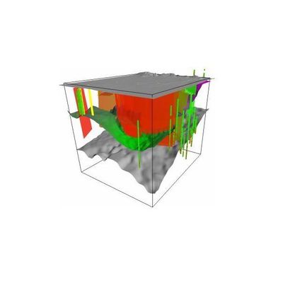
TerraMath - 3D Modeling Geology Software
For most applications 3D representations of the Geology are required nowadays. Our software & algorithms offer: Import of data like well logs, strike / dip, 2D sections (seismic or drawings) or lithological surface data. Constructing sections based on those data. Advanced 3D interpolation algorithms honoring strike/dip and faults.
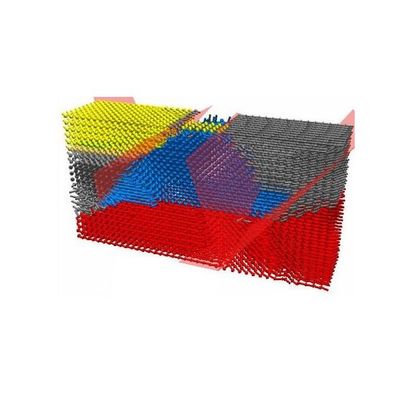
TerraMath - 3D Topology and Analysis Software
Automatic extraction of information from 3D data sets. Functions added to WinGeol allow: Import of data derived from AutoCAD 3D solids (using MMT as middleware), STL and point cloud (in prep.) data. Triangulation and geometric topology. Rule based topology creation, extraction of surface areas defined by properties or property differences to neighboring areas. or of linear feature which define the boundaries between areas. Shape analysis (elongation, rounding, ...; in prep.).