
TerraMath software
GIS & Remote Sensing
TerraMath - Geographic Information Systems (GIS) & Remote Sensing Software
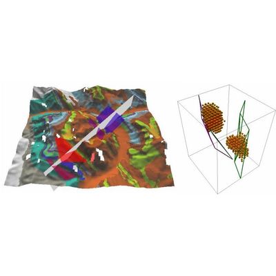
Geographic Information Systems (GIS) are always 3D and 4D for us - as the earth is a 3D body moving through time (4D). Our interest is to deduct 3D geological information from remote sensing images and digital elevation data (DEM) and combine them with other datasets like outcrop data, well logs, geological profiles, seismic, geophysics to build 3D models for applications in exploration, mining, groundwater modeling and others. We start where other service provider stop! Our focus is to integrate new functions required by our clients. As we use our own software libs we do not depend on the functionality of other software vendors.
TerraMath FaultTrace - Model WinGeol Based - Trace Geological Faults Software
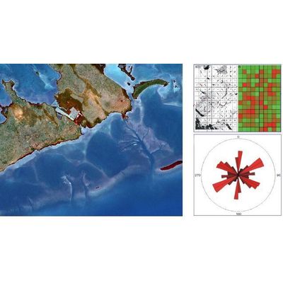
FaultTrace is used to trace geological faults or the outcropping of geological strata on the surface of the earth. In this way 3D information is gathered about these structures. This knowledge is mandatory for building accurate models of the subsurface as required in many applications (geothermal, mining, oil exploration, academic studies and others). We developed a Google Earth based version as well but as the user has limited control on the data used - the elevation data Google is using having much lower spatial resolution than the satellite images draped on it - we do not recommend this version for serious work as errors occur frequently. Nevertheless this tool might be ok for the one looking for a fast overview and is aware of the limitations.