

Wilcox Environmental Engineering, Inc. services
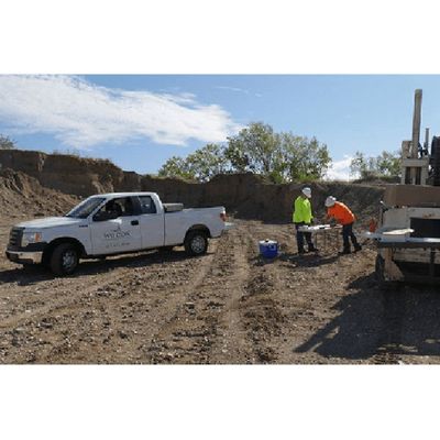
Investigation and Remediation Services
Wilcox Environmental Engineering has developed an exceptional reputation that emphasizes cost reduction and site closure as the primary objectives from the start of each project. Since 2008, we have achieved No Further Action status (NFA) for over 85 sites in Indiana, Illinois, Kentucky, and Tennessee. Our wide-ranging experience includes developing thorough conceptual site models that allow us to design and implement effective, economical solutions for remediating and managing risks associated with petroleum hydrocarbons, chlorinated solvents, and metals associated with commercial sites, industrial operations and processes, and waste disposal facilities.

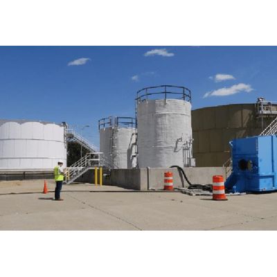
Air Analysis Services
Wilcox Environmental Engineering has decades of experience partnering with industry to meet regulatory standards for air emissions, most often with respect to state requirements for air permits. We have successfully completed stack testing for automotive facilities, refineries, iron and steel foundries, asphalt plants, agricultural facilities, utility companies, landfills and other municipal and manufacturing facilities.
Due Diligence Services
Understanding, qualifying, and identifying environmental liabilities is an essential component when considering purchasing, selling, or refinancing commercial and industrial properties. Wilcox provides due diligence services that help protect clients from incurring undue environmental liabilities. Our conversant team provides quality due diligence services to real estate investors, banks, property developers, and commercial and industrial clients.
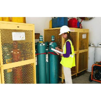
Health and Safety Services
Wilcox Environmental Engineering employs an experienced team of Professional Engineers, Certified Industrial Hygienists, Certified Indoor Environmental Consultants, and Licensed Lead and Asbestos Inspectors to provide clients with a comprehensive range of environmental health and safety expertise and services.
Data Management & GIS Services
Unmanned Aerial Services
3D Site Model; Sketchfab 3D model. Embedded html. Websites. EQulS dashboards. Virtual reality.
EHS Software Consulting and Implementation Services
Our EHS Software Consulting and Implementation services include working with client to identify software. After selection, we work them through the implementation process and setup a change management and support program. Our services include the setup and implementation of mobile field data collection.
Geospatial Solutions
Wilcox has outlined the following phased approach which allows for conservative steps, limiting risk to the business. There are several alternative paths and options and we have included those for consideration. These alternative paths can be pursued at any time and selecting one path does not exclude the ability to switch paths as the service line grows or adapts.
Drone Services
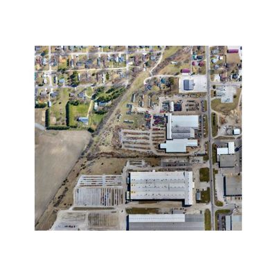
Orthomosaic Mapping Services
Orthomosaic maps are created by stitching multiple overlapping drone aerial images, via mapping software, into a single geometrically corrected or "orthorectified" aerial map. Orthomosaic maps provide high-resolution image quality and true-to-scale relative accuracy of the earth`s surface. Orthomosaic maps can also provide a high level of absolute or global accuracy by implementing ground control points.
Topographic Mapping Services
Millions of X.Y.Z data points are generated when a drone collects overlapping aerial images from a typical site. These data points allow for the creation of topographic maps with contour intervals as dense as 1 ft. Topographic maps created by drone aerial imagery provide the same relative and absolute accuracy as orthomosaic maps.

Commercial and Industrial Inspections Services
Orthomosaic maps are created by stitching multiple overlapping drone aerial images, via mapping software, into a single geometrically corrected or “orthorectified” aerial map. Orthomosaic maps provide high-resolution image quality and true-to-scale relative accuracy of the earth’s surface. Orthomosaic maps can also provide a high level of absolute or global accuracy by implementing ground control points.