

Ambiental Risk Analytics
- Home
- Companies
- Ambiental Risk Analytics
- Services
- FloodMap - Emergency Response Services
FloodMap - Emergency Response Services
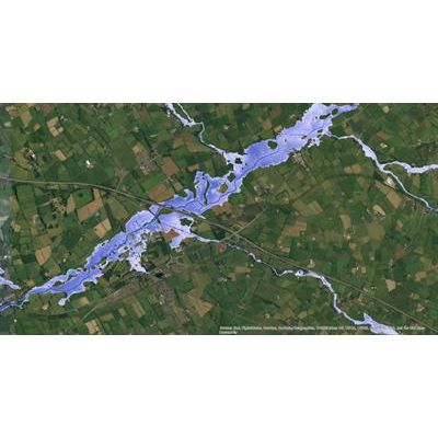
Our flood maps are used by insurers, government agencies, property developers and emergency response services to visualise, assess and understand potential flood risk. Using our proven flood simulation software and high-quality topographical data, we can generate flood maps or flood risk datasets for most countries around the world. Many are already available.
Most popular related searches
emergency response service
emergency response
flood mapping
flood risk
flood modeling software
flood modeling
flood software
flood level
At a Glance
search glass
- Detailed visualisations of potential flood risks
- Multiple flood sources available
- Varying levels of detail
- Can be integrated into your existing system
- We have flood maps for most countries and can create new ones on request