

Geo2X SA software
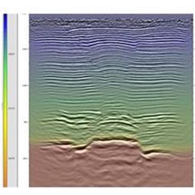
Geo2X - Vibroseis Exploration Software
Vibroseis is based on the analysis and processing of reflected waves upon geological boundaries, just as reflection seismology. The reflections depend on density and seismic velocity contrasts. Sections can highlight stratigraphic boundaries, tectonic features, dips, faults, folds or reservoirs.
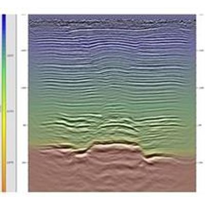
Geo2X - Reflection Seismology Software
Reflection seismology is based on the analysis and processing of reflected waves upon geological boundaries. The reflections depend on density and seismic velocity contrasts. Sections can highlight stratigraphic boundaries, tectonic features, dips, faults or folds.
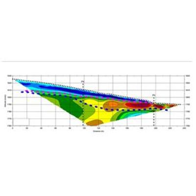
Refraction Seismology Software
Refraction seismology investigates refracted wave seismic velocities. The analysis is based on precise measurement of the propagation time between an energy source and vibration captors called geophones. Refraction seismology sections allow us to define the present lithologies as well as their geometry and velocity variations within.
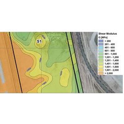
Geo2X - MASW & Geotechnics Software
Multichannel Analysis of Surface Waves (MASW) is based on the study of surface waves (Rayleigh & Love) in the ground. The acquisition of MASW allows two-dimensional VS sections, that is the shear wave velocity, to be obtained. These velocities are typically used for earthquake risk zonation, usually through the calculation of the VS30 norm (Eurocode 8).
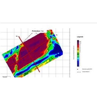
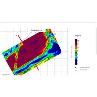
Geo2X - Electrical Methods Software
Electrical methods are based on the measurement of apparent electrical resistivities in the ground with a multi-electrode array. They include electrical profiling, vertical electrical sounding and tomography in 2D / 3D.
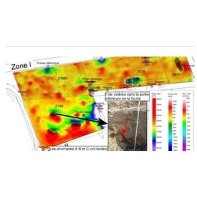
Geo2X - Electromagnetism Software
Electromagnetic technology allows ground conductivity measurements without setting ground sensors. The measurements are inductive and this method allows studies in most geological terrains, even for the most resistive superficial layers such as sand, gravel and asphalt. EM can map geological layer variations, contaminated soils and any surface with conductivity variations.
Geo2X - Magnetic Prospecting Software
Magnetic prospecting in the ground is based on the measurement of the Earth’s magnetic field and its local variations caused by the presence of natural (or manmade) objects. These variations depend on the magnetic susceptibility of the buried objects and the background Earth’s magnetic field.
Geo2X - Gravity Exploration Software
Gravity exploration methods study the spatial variation of the gravity field. The variations can depend on the heterogeneous distribution of underlying geological units. A sharp analysis on these variations allows the reconstruction of an underground density model.
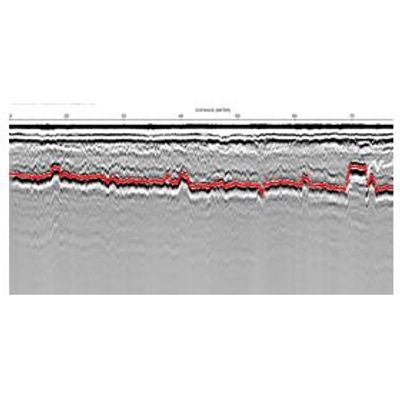
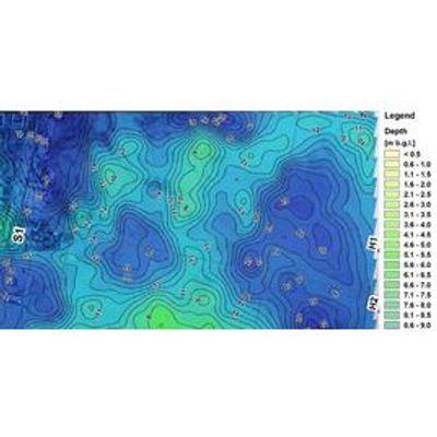
Geo2X - Ground Penetrating Radar Software (GPR)
Ground Penetrating Radar (GPR) is based on the emission of electromagnetic waves into the ground and the detection of reflections from objects in the subsurface. From the measured travel-times, the location and depth of these objects can be determined.