

- Home
- Companies
- Geotomographie GmbH
- Applications
Geotomographie GmbH applications
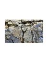
Fault zones: Geological faults are related to an increase in weathering and loosening up of the surrounding rock, which causes an increase in hydraulic routing. This lowers the rigidity of the rock and increases the risk for constructing new buildings. In the event of an earthquake, even dislocations are possible along the fault. Seismic refraction measurements enable the mapping of seismic velocities and related material properties. The lateral variations of these velocities then indicate the location of fault zones.

Site classification according to EC8 and DIN4149. In order to quantify the design load for buildings due to an earthquake the Eurocode 8 (EC8) and the DIN4149 require the classification of the ground. The dominating or average shear wave velocity in depths down to 30 m is most often used for this classification. Beyond that the standards request certain design features as flexible foundation beams based on the class of the subsoil which are affecting the costs of a building. A seismic survey can often reduce the costs because otherwise necessary safe assumptions concerning the classification are avoided. Surface wave measurements such as MASW are especially suited to determine shear wave velocity profiles at these shallow depths.
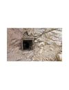
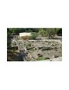
Karst structures: Solution processes are a common phenomenon in limestones and dolomites which can lead to karstification causing in many cases cavities. They can be air-filled or filled with fine-grained material, which decrease the soil stiffness and thus the load capacity. Exploratory drillings, which are generally used for soil investigations, provide only local information about the subsoil conditions and are not suitable to detect small-scaled structures in a geologically heterogeneous environment. Therefore, seismic methods are used for a detailed exploration of geological structures and cavities, whose elastic properties differ from the environment’s properties. In particular, seismic tomography which is carried out between two drillings, is well suited to characterize the location and dimensions of shallow and deep structures.
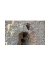
Sinkholes: Natural cavities or cavities caused by mining can collapse what lead frequently to sudden subsidence of the subsurface material (sinkholes). Especially in urban areas, considerable damages on buildings can be observed due to the collapse.
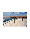
Strength characterization: Seismic methods are suitable to study the strength characteristics of dyke and dams. Seismic measurements are sensitive to density changes and compactness of soils. Therefore, areas with inadequate compactness of dykes can be detected. A correlation with SPT/CPT (Standard/Cone Penetration Testing) is often done because these methods also depend on the mechanical properties of the soil.
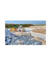
Objects and structures: Geomagnetic is a cost-effective and quick method to locate archaeological objects or structures in the underground. The magnetic properties of these objects differ from the environment’s properties producing visible magnetic anomalies. The objects can consist of pipes and tanks made of metal or archaeological structures such as waste pits, trenches, grave sites, iron objects, foundations and walls.
Clay exploration: The exploration of clay deposits is of great importance for the nonmetallic minerals industry mainly. Due to the higher conductivity of clay compared to coarser sediments such as sand and gravel geoelectric is an appropriate method to determine the expansion and thickness of clay deposits.
Ship locks and lifts: A ship lock is an engineering structure which enables ships to overcome the level difference between two waterways. Water level is raised or lowered by filling or emptying the lock chambers. Filling and emptying a lock chamber is a central process of the ship lock which causes high cyclical loads on the underground. therefore, an a-priori estimate of the soil behaviour under loads is crucial for geotechnical engineers to select the best design parameters and to avoid undesired deformations on the construction.
Wind power plants: Wind turbines requires a stable foundation to derive dynamic force into an intact ground. e integrity of the subsurface needs to be inspected prior the design. Underground cavities or tunnels of man-made or natural origin may lead to undesired subsidence or foundation failures.