
Killet GeoSoftware Ing.-GbR (KilletSoft) software
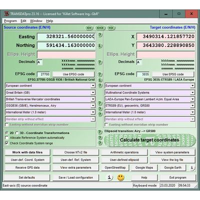
TRANSDATpro - Model 27.24 - Coordinate Converter for Worldwide Geodetic Coordinate Transformations and Datum Shifts
TRANSDATpro is a coordinate converter that performs coordinate rransformations fast and with high accuracy. The geodetic program supports worldwide thousands of Coordinate Systems, geodetic Reference Systems and Datum Shifts, user-defined systems, 2D/3D transformations, INSPIRE, NTv2, HARN, EPSG, GPS, continental drift and more. The coordinate converter reads and writes the file formats Text, CSV, SDF, dBase, Arc-Shape, Arc-Generate, KML, GPX and others. Furthermore: Outdoor GPS reception, mapping in Google Earth, Google Maps and OpenStreetMap, Meridian Convergence and Extra Parameter, Polygonal scopes in NTv2 files, multilingual user interface.
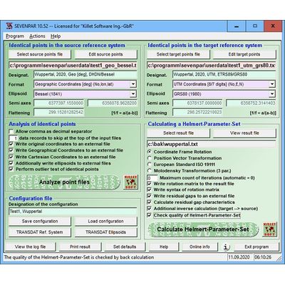
SEVENPAR - Model 14.10 - Modelling of Helmert Seven Parameter Sets from identical points in two Reference Systems
SEVENPAR geosoftware calculates exact transformation parameters for the spatial Helmert Seven Parameter Transformation according to Bursa-Wolf and for the Molodensky Three Parameter Transformation on the basis of identical points in different Reference Systems. The applied identical points are intensively checked for outliers and plausibility. The quality of the determined parameters is checked by cross-calculation and statistical methods and the result is stored in a cluster field. Bad matching identical points are determined and suggested for rectification. With the modelled Helmert Parameter Sets GIS and transformation programs can perform precise coordinate transformations between two geodetic Reference Systems.
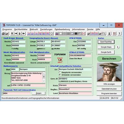
TOPOWIN - Model 23.02 - Topographic and Cartographic Information Register Software
TOPOWIN is a topographic information system and country-wide register of the German Topographic Cartographies, the German Basic Cartography and of localities with georeferences in different Coordinate Systems.
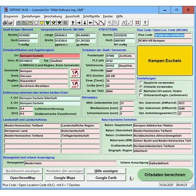
ORTWIN - Model 20.02 - Cities and Municipalities of the Federal Republic of Germany with current urban data
ORTWIN is a program for the country-wide inquiry of the localities in Germany to find cities and towns, urban districts, postal zip codes, dialling codes, coordinates and elevations, landscape and climatic data and other urban data and also to perform perimeter searches and distance calculations.
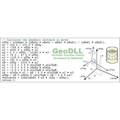
GeoDLL - Model 24.33 - Geodetic Development Kit Development Tool for coordinate transformation and GIS
GeoDLL is a Geodetic Development Kit or a Geodetic Function Library for worldwide 2D and 3D Coordinate Transformations and Datum Shifts with highest accuracy and for calculating Meridian Convergence and many Extra Parameters. Furthermore: Helmert and Molodensky Parameters, NTv2, HARN, INSPIRE, EPSG, Digital Elevation Model (DEM), distance and Time Zone calculations and much more. GeoDLL is available as 32Bit and 64Bit DLL and as C++ source code.
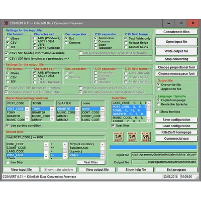
CONVERT - Model 14.01 - Data Conversion Freeware File Converter converts file formats and Character sets
CONVERT data converter freeware converts databases and files between the file formats dBase, CSV and SDF and the character sets ANSI, ASCII, UTF8 and Unicode and allows in the same time to sort the data and to do selections.
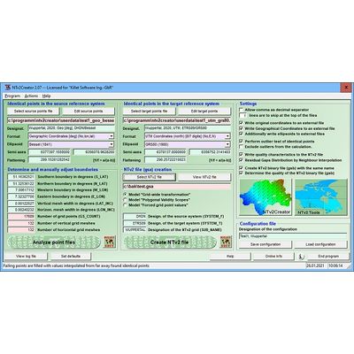
NTv2Creator - Model 5.17 - Modelling of NTv2 files from Identical Points in two Reference Systems
The geosoftware NTv2Creator provides a powerful development tool for the modeling and creation of accurate NTv2 files from identical points in two different Reference Systems The software analyses two files with identical points and suggests the boundaries and mesh sizes which can then be changed manually. Finally, a highly accurate NTv2 file is generated using small-scale three-dimensional 7-parameter Helmert transformations around each grid point and subsequent Natural Neighbour Interpolation for residual gap distribution. NTv2Creator provides three different mathematical models for the creation of NTv2 files.
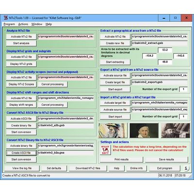
NTv2Tools - Model 7.03 - Tools for analyzing, developing and processing of NTv2 files in Binary and ASCII Formats
NTv2Tools geosoftware provides tools for the developing and processing NTv2 files in binary and ASCII format. The available tools can be used to analyze and manipulate NTv2 files and represent the results on the screen and on the printer, as well as in graphics and in files.
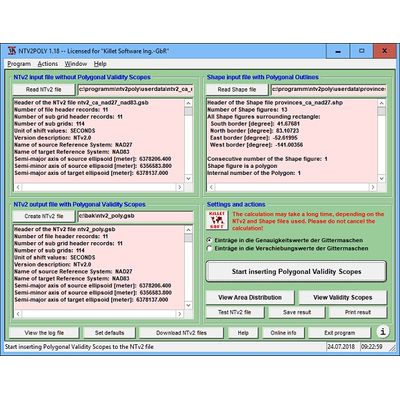
NTv2Poly - Model 7.03 - Inserting Polygonal Validity Scopes into NTv2 Binary Files using Outlines from Shape Files
NTv2Poly geosoftware replaces the rectangular activity scope contained in NTv2 files with a Polygonal Validity Scope, which is realized with an outline file in classic Shape Format. Invalid calculations outside the Polygonal Validity Scope thus can be excluded or acknowledged by a warning.
Geodata Germany - Model 28.01 - Databases with current georeferenced urban spatial data
Geodata Germany is an up-to-date database with the center coordinates of all German cities and municipalities and of districts, postcodes, area codes and administrative units. It contains tables with natural areas, landscapes, travel areas, snow and wind loads, solar radiation, precipitation amounts and more. All data can be assigned to cities and municipalities using the official municipality key. The geodata is georeferenced with terrain heights and coordinates in the UTM/ETRS89, GK/DHDN and Geo/WGS84 systems and is suitable for geocoding, data enrichment and radius searches. The geodata can be provided as text, CSV, SDF, dBase, SQL files with ASCII, ANSI, UTF8, Unicode character set.