

Teledyne Optech Incorporated products
Airborne Survey - Airborne Lidar Systems
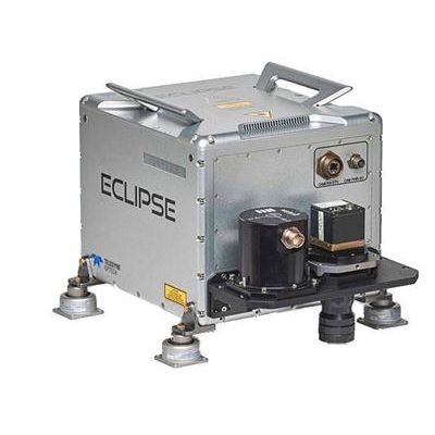
Optech Eclipse - Autonomous Lidar and Imagery Data Collection System
The Optech Eclipse is the first autonomous airborne system to focus on operator-less data collection from tightly integrated passive and active imaging sensors on low-cost platforms. Designed specifically for the efficient data collection of smaller project areas and corridor applications, the Eclipse requires only a pilot for navigation.
Optech Galaxy - Airborne Lidar Systems
Galaxy is the next generation of airborne solutions, packing more power and accuracy into a tiny footprint than any other sensor. Designed for everything from wide-area mapping to corridor surveys, Galaxy is truly a universal sensor that rivals larger systems with its ultra-dense data and industry-leading measurement precision and accuracy. Galaxy’s new PulseTRAK™ and SwathTRAK™ technologies (patents pending) make surveying simpler than ever before by providing unique innovative feature sets that maximize productivity, increase information content and reduce overhead costs. Whether installed in a tactical UAV, integrated in a helicopter pod for powerline surveying, or gyro-stabilized with an orthometric camera for wide-area mapping, Galaxy’s performance and capability is out of this world.
Airborne Survey - Coastal and Marine Systems
Optech Titan - Multispectral Lidar System
As the world’s first multispectral airborne lidar sensor, Optech Titan is opening up a new era in lidar survey and mapping. 3D surface spectral response information sensitive to the emitted wavelengths can now be derived day or night from complex environments using a single lidar sensor. Such information opens up exciting new applications and can significantly improve existing application results moving forward. Whether it is high density topographic surveying, seamless shallow water bathymetry, environmental modeling, impervious urban surface mapping, or vegetative classification, the Optech Titan breaks new ground in active sensor design and performance.
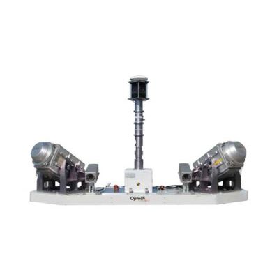
Optech CZMIL Nova - Airborne Coastal and Marine Mapping Systems
The most powerful airborne coastal and marine mapping system on the market just got better. Optech CZMIL Nova is not only the most capable airborne bathymetric mapping system available today; it is also the most efficient. With a powerful yet more efficient laser, it maps deeper while flying higher, reaching depths of 80 meters in clear waters. The enhanced design and automated processing tools produce simultaneous high-resolution 3D data and imagery of the beach and shallow water seafloor, including coastal topography, bathymetry, benthic classification and water column characterization.
Airborne Survey - Camera Systems
Teledyne Optech - Model CM-11K - Medium-Format Metric Camera
The Teledyne Optech CM-11K is purpose-built for high resolution imaging from airborne platforms and delivers the unique benefits of combining our patented piezoelectric Forward Motion Compensation (FMC) with a fully-electronic shutter for low maintenance operation. The on-board FMC electronics enable integrators and original equipment manufacturers (OEM) to implement custom solutions for high-resolution mapping, tactical ISR, and wide-area surveillance.
Airborne LiDAR Survey System
Optech Orion - Model ALTM - Airborne Laser Terrain Mapper
The Optech Orion Airborne Laser Terrain Mapper is an ultra-compact total mapping solution with industry-leading data precision and accuracy. Modular components, direct upgrade options and plug-and-fly passive imaging sensors deliver scalable and highly flexible configurations for maximum flexibility in all application spaces.
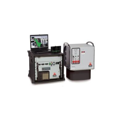
Optech Pegasus - Model ALTM - High-Performance LiDAR Mapping System
The Optech Pegasus is a high-performance lidar mapping solution that is designed for maximum collection efficiency, data accuracy and high point density. A multi-laser sensor, Pegasus includes a fully embedded, high-resolution orthometric camera and delivers extremely dense and information-rich datasets. Pegasus provides the highest point density and data accuracy at the lowest cost per square mile/km.
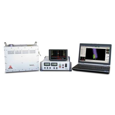
Optech - Waveform Recorder
The Waveform Recorder provides waveform capture capability for all ALTM models. Benefits include true ground detection, increased return density, improved target separation distances, and improved classification results. Available as a small strap-on peripheral, the Waveform Recorder is shipped and installed in the field directly by clients in a matter of minutes. This standalone configuration also enables the Waveform Recorder to be moved from system to system as the need arises, giving surveyors the on-demand capability they need.
Mobile Survey
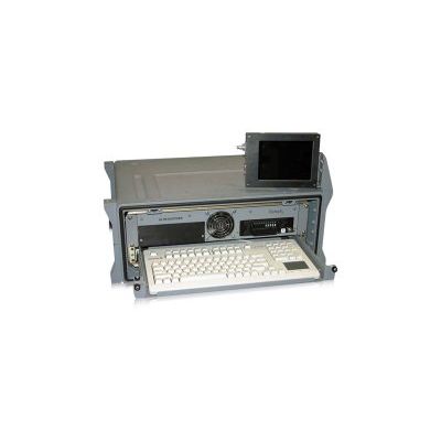
Optech - Model Lynx SG - Mobile Mapper
0860 11 78 The Lynx Mobile Mapper™ SG1 has two 600-kHz sensors for survey-grade precision. It’s the fastest and most efficient mobile lidar mapping system available, with incredible detail and measurement rates of up to 1.2 million measurements per second. Collect engineering survey-grade lidar and image data from a vehicle at cruising speeds, while previewing the quality of your data in real-time 3D inside the vehicle. The ability to control several integrated cameras, including the Point Grey Ladybug, adds further value to a system that is already considered the premium choice for mobile surveys where accuracy, precision and resolution are critical. A complete software solution includes best-in-class survey planning, project execution, inertial/position processing, lidar post-processing and information extraction.
Static 3D Survey
Optech - Model ILRIS - Terrestrial Laser Scanner
ILRIS is a fully portable, laser-based ranging and imaging system for the commercial survey, engineering, mining and industrial markets. A compact and highly integrated instrument with digital image capture and sophisticated software tools, ILRIS is an industry-leading solution that addresses the needs of commercial users. It is field-ready and requires no specialized training for deployment. ILRIS is packaged for several applications, including automated monitoring and long-range scanning.