

Geophysical Survey Systems, Inc., (GSSI) products
Concrete - Flex NX
GSSI - Model Flex NX - Complete Concrete Scanning System
Flex NX offers best-in-class data quality, one-pass cross-pol scanning, wireless connectivity, and our innovative Flex Mode capability. This all-in-one system is optimized for clearing core and drill locations, and it is the perfect solution for long saw cuts and large area scans.
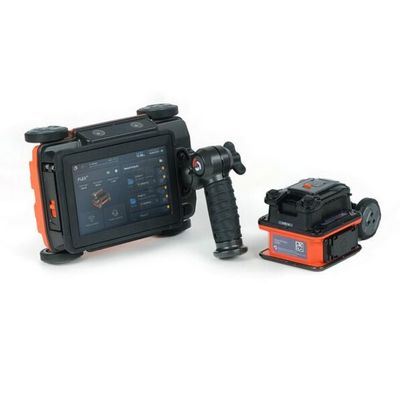
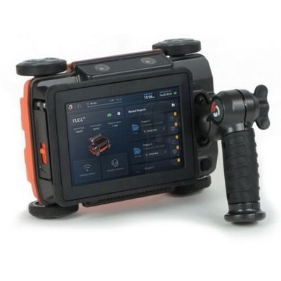
GSSI - Model Flex NX Kit: NX25 - Complete Concrete Scanning System
Flex NX offers best-in-class data quality, one-pass cross-pol scanning, wireless connectivity, and our innovative Flex Mode capability. This all-in-one system is optimized for clearing core and drill locations, and it is the perfect solution for long saw cuts and large area scans. Connecting the wireless NX25 satellite antenna makes it easy to scan tight spaces, walls, and ceilings. NX25 can operate independently as well, adding unmatched value to this 2-in-1 scanning kit.
Concrete - Flex LT
GSSI - Model Flex LT - Handheld Concrete Scanning System
Flex LT offers best-in-class data quality and one-pass cross-pol scanning for budget-conscious scanners. This all-in-one system is optimized for clearing core and drill locations, and it is the perfect solution for long saw cuts and large area scans.
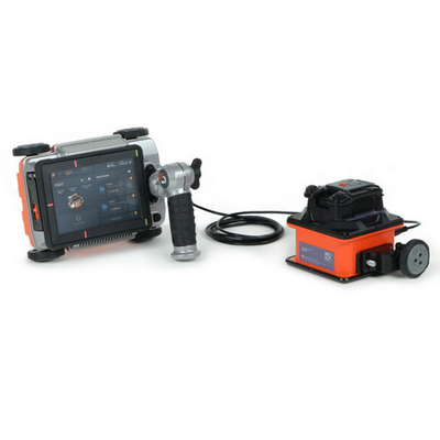
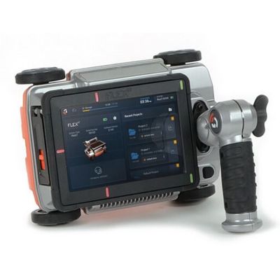
GSSI - Model Flex LT Kit: NX15 Antenna - Handheld Concrete Scanning System
Flex LT offers best-in-class data quality and one-pass cross-pol scanning for budget-conscious scanners. This all-in-one system is optimized for clearing core and drill locations, and it is the perfect solution for long saw cuts and large area scans. Use the NX25/NX15 wired Tether Module to connect a NX15 satellite antenna and easily scan thick concrete and locate deep targets below grade. NX15 can operate independently as well, adding unmatched value to this 2-in-1 scanning kit.
Utility
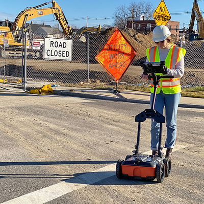
GSSI - Model UtilityScan Pro - Utility Mapping and Locating GPR System
With UtilityScan Pro, users can quickly identify and mark the position and depth of metallic and non-metallic objects; including utilities such as gas, communications and sewer lines as well as underground storage tanks and PVC pipes. Based on the SIR 4000 controller, the UtilityScan Pro provides the GPR professional with solutions to any underground locating situation.
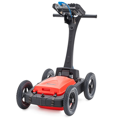
GSSI - Model UtilityScan - GPR System for Utility Locating
Locating and marking underground utilities in real-time in the field has been a powerful application of ground penetrating radar (GPR) for many years. A knowledgeable utility locator with a GPR system as part of their toolbox is able to accurately identify buried utilities. UtilityScan is built for the utility locating professional to accelerate workflow from target detection to reporting.
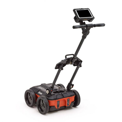
GSSI - Model UtilityScan DF - Locate and Map Underground Utilities System
UtilityScan DF incorporates our innovative dual-frequency digital antenna (300 and 800 MHz) and an easy-to-use touchscreen interface to view shallow and deep targets simultaneously in a single scan.
Transportation
GSSI - Model PaveScan RDM 2.0 - Non-Destructive Asphalt Density Testing Equipment
The PaveScan RDM 2.0 is our second-generation asphalt density assessment tool that is ideal for uncovering inconsistencies that occur during the paving process, including poor uniformity and significant variations in density. By detecting these problems, PaveScan RDM 2.0 helps to avoid premature failures such as road raveling, cracking and deterioration along joints.
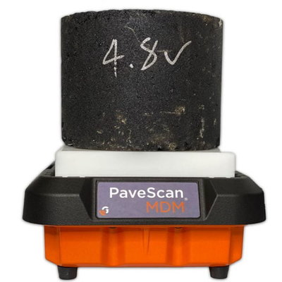
GSSI - Model PaveScan - Mix Design Module (MDM)
With the PaveScan Mix Design Module (MDM), paving contractors can now be alerted immediately to changes in the mix. Since PaveScan MDM is sensitive to subtle changes in aggregate, mix, and moisture, comparing daily samples against approved mix designs makes any deviations apparent and helps to fix any problems before the mix is deployed in the field. With one five-minute lab test, users can accurately reveal problems before any need for silo dumps or other costly remediation.
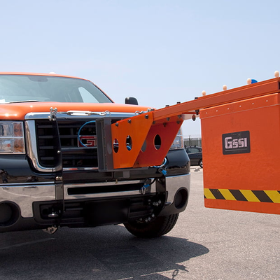
GSSI - Model RoadScan 30 - Complete GPR System for Road Inspection
The RoadScan 30 system provides users with an effective tool for quickly determining pavement layers at high speeds. RoadScan is able to collect data densities not obtainable using other labor-intensive methods commonly used for pavement testing.