
- Home
- Companies
- GeoView, Inc.
- Services
GeoView, Inc. services
Land Based Methods

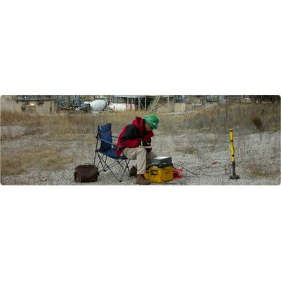
Electromagnetic Methods
Electromagnetics uses inductive techniques to measure conductivity of the subsurface without the need of electrodes or ground contact. The methods include frequency domain electromagnetics (Geonics EM-31, EM-34, EM-38 and GSSI Profiler), time domain electromagnetics (Geonics EM-61, Geonics PROTEM systems and White handheld systems), and VLF systems. Depending on the target, the depth of investigation can range from a few meters to several hundred meters.
Electronic Utility Locating Services
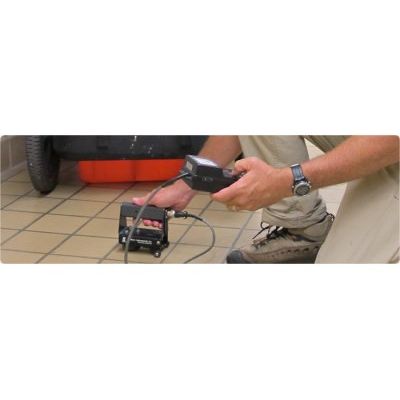
Conventional Pipe and Cable locators are an important tool used in most utility designation studies. The locators can be used in either a passive or active mode. The most common use for the passive mode is to find cables and conduits carrying live power (50-60 Hz) and communication cables (29-33Hz) signals. In the active mode, a current is transmitted or broadcast into a metal pipe or conduit and the path of the pipe/conduit is identified by following the signal with a portable receiver. It is used to trace out cast iron pipes, metal water and sewer lines, utilities that have trace wires, and inactive power and communication lines.
Impact Echo Method
The Impact Echo Method is used to determine the thickness of concrete, wood, stone, and masonry structural members. It can also be used to determine the condition when voids, honeycombing and/or cracks are suspected. A solenoid is used to create a high frequency compressional wave that reflects off the bottom of the structure or from a flaw in the structure. The reflected wave is then recorded, processed and displayed. GeoView`s Impact Echo Testing equipment can test concrete from 1.5 inches to 72 inches thick. It meets the standards set forth in ASTM C1383-04.
Pile Integrity Testing Services
Pile Integrity Testing, also known as Sonic Echo Testing and low strain dynamic testing is used to determine the length and integrity of deep foundations and driven piles. The method works well in concrete or timber foundations that are not excessively slender. In order to perform the test, the top (preferably) or side of the foundation must be accessible. An accelerometer is placed on the top of the foundation and a lightweight hammer is used to impact the top the foundation adjacent to the accelerometer. The impact produces a compression wave that travels down the foundation or pile at a constant wave speed. Changes to the foundation, such as a reduction in diameter, a crack, a void, or the end of the foundation produce wave reflections.
Seismic Methods
All seismic methods measure the travel-time and frequency of elastic waves as they propagate through the subsurface. The methods commonly used in shallow geophysics involve using an impact source (hammer, weight drop, explosive source) to generate the seismic wave and recording the arrival of the waves with a seismograph and a series of geophones. The types of seismic methods are divided into broad categories on the basis of the geometry of the ray paths (refracted or reflected), the type of energy used (Shear wave, compressional wave or surface wave) and whether the survey is conducted on the surface or in a borehole.
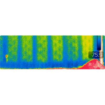
Thermal Imaging Services
Thermal imaging cameras detect radiation in the infrared range of the electromagnetic spectrum (roughly 9,000–14,000 nanometers) and produce images of that radiation which are called thermograms. The amount of radiation emitted by an object increases with temperature; therefore, thermography allows one to see variations in temperature to a range of 0.1o C. A thermal imaging camera is able to view and record these variations in temperature. GeoView owns and uses state of the art FLIR thermal imaging cameras and our operators are ITC Infrared Thermography Certified based on the requirements outlined by ANSI/ASNT CP-105 and CP-189 of the American Society for Non-Destructive Testing.
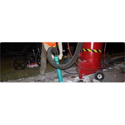
Vacuum Excavation Services
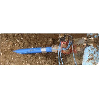
Vacuum excavation is a tool that is used to confirm, safely expose and examine underground utilities that have been identified using geophysical methods. An air “knife” is used to loosen the soil and a powerful suction hose is used to remove the soils overlying the utility. Once the target utility has been exposed, measurements can be made regarding the composition, diameter, depth and centerline of the utility. This information is often crucial for design/build projects, pipeline installations and for when soil borings are planned near critical (petroleum and fiber optic) lines. The results can either be marked in the field or documented in a surveyed site plan or on a site figure prepared and signed by a Professional Licensed Surveyor.