

GAEA Technologies Ltd. software

GAEA - Model StrataExplorer - Subsurface Mapping and Data Management Software
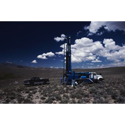
StrataExplorer is an application suite for subsurface mapping and data management. The program can be used to evaluate contaminants, soil and rock properties, minerals, oil and gas deposits, and oil sands. It is ideal for the environmental, geotechnical, mining, oil sands, and petroleum industries. StrataExplorer is comprised of a base application and several extension modules. The base application is used as a platform that all of the other modules build upon.
GAEA - Model WinLoG - Geotechnical 5 Extension Module Software
The WinLoG version 5 extension module of StrataExplorer can be used to quickly and easily create, edit and print boring and well logs for a variety of industries. The module is a major upgrade to our very popular WinLoG version 4 program. WinLoG is used by more than 3000 firms in more than 80 countries worldwide. The geotechnical version of this module has been specifically designed for the geotechnical industry with data types and columns tailored to this industry.
GAEA - Model WinFence - Geotechnical Cross-Section Extension Modules
The WinFence cross-section extension module of StrataExplorer can be used to quickly create detailed full color cross-sections. This module is a major upgrade to our very popular WinFence program. The geotechnical version of this module has been specifically designed for the geotechnical industry. A wide variety of strata can be used to create cross-sections. Depending on the industry, types of strata that can be used include layers, faults, lenses, intrusions, and alteration zones (mineralization, contamination, hydrocarbons, shear strength). Very detailed and complicated stratigraphy can be represented and easily drawn.
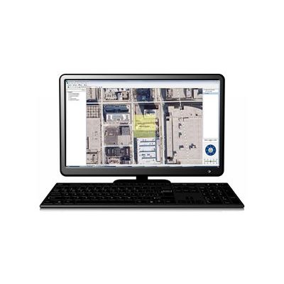
GAEA - Model SE-GIS - Geographic Information Software
The SE_GIS module provides the geographic information system (GIS) for the StrataExplorer base application. It is used as the primary display and selection interface for the base application. Without the SE-GIS module the application will display of list of projects only and not display basemaps. There are now two types of basemaps, web map services or static. The GIS stores all of the basemap, project, well, boring, cross-section, and other spatial data for the application.
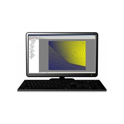
GAEA - Model SE-Map - Geotechnical Extension Module Software
This extension module of StrataExplorer is used to grid and contour data. The module can grid and contour many types of boring and well data, stratigraphic data from cross-sections, and other types of data. This version of the module has been specifically designed for the environmental industry After the data has been entered in the WinLoG and WinFence modules, it can be automatically extracted and used to generate contour maps.

Model SE - Extension Structures Module Software
This extension module of StrataExplorer is used to create simplified buildings, structures, and excavations for display in 3D. After they have been created these buildings and excavations can be used to show the positions of these structures in 3D relative to borings, wells, cross-sections, contour maps, and solids.
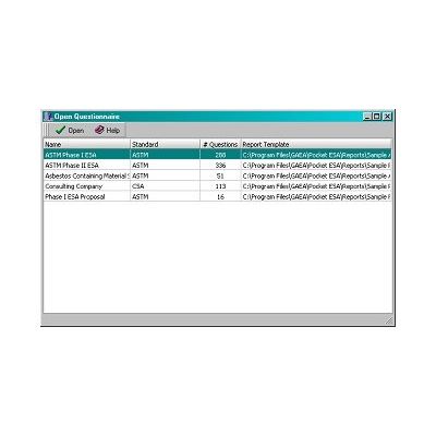
GAEA - Pocket ESA Program Software
Pocket ESA has been designed to minimize the amount of time required to generate standard Environmental Site Assessment reports and to maximize the flexibility of the final report. The data can be collected either on a Pocket, Tabloid, Laptop, or Desktop PC. A wide variety of reports can be created; including Phase I ESAs, Phase II ESAs, Environmental Compliance, and Transaction Screening. The reports can be tailored to any standard such as CSA and ASTM.
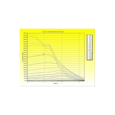
GAEA - Model POLLUTEv7 - Migration Analysis Program
The POLLUTEv7 program provides fast, accurate, and comprehensive contaminant migration analysis capabilities. This program implements a one and a half dimensional solution to the advection-dispersion equation. Unlike finite element and finite difference formulations, POLLUTEv7 does not require a time-marching procedure, and thus involves relatively little computational effort while also avoiding the numerical problems of alternate approaches.
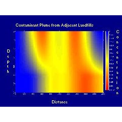
GAEA - MIGRATEv9 Software
Using the MIGRATEv9 software, contaminant transport from multiple sources, either at the surface or buried, can be modeled quickly and accurately in two-dimensions. Unlike finite element and finite difference formulations, MIGRATEv9 does not require the use of a `time-marching` procedure. MIGRATEv9 uses a finite-layer technique (Rowe & Booker, 1991; Rowe et al, 1994) that provides numerically accurate and stable results, while requiring relatively little computational and data entry effort.