

Esri software
Specialized Applications
ArcGIS for INSPIRE
The INSPIRE directive sets out a framework and timetable for sharing spatial data within the European Community to help address pan-European issues in a multinational and multiagency spatial data infrastructure (SDI). ArcGIS provides a powerful and comprehensive SDI solution that now includes capabilities to ensure INSPIRE compliance supporting data, services, and metadata, which are delivered in the new ArcGIS for INSPIRE.
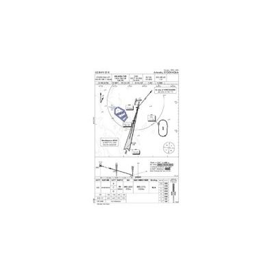
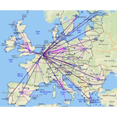
Esri Aeronautical Solution
Esri Aeronautical Solution provides a true GIS-based platform to manage aeronautical data and rapidly produce high-quality charts that adhere to industry- and organization-specific requirements. With Esri Aeronautical Solution, civil and military agencies, commercial airlines, and chart producers can create, maintain, and use standard aeronautical products based on the latest digital data.
Esri CityEngine
Esri CityEngine is a stand-alone software product that provides professional users in architecture, urban planning, entertainment, GIS and general 3D content production with a unique conceptual design and modeling solution for the efficient creation of 3D cities and buildings. Create stunning city models in less time with Esri CityEngine software—the tool of choice for 3D city modeling in urban planning, architecture, simulation, game development, and film production. CityEngine delivers a full suite of industry-leading procedural tools to aggregate geospatial data, lay out and edit street networks, generate and modify buildings, create 3D road profiles and distribute street furniture, control the shape of the skyline, and analyze urban planning projects.
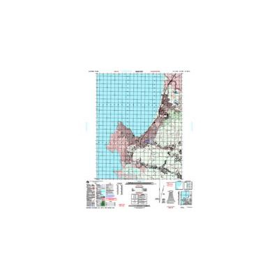
Esri Defense Mapping
Esri Defense Mapping allows defense industry users to produce and maintain high-quality topographic databases and cartographic products. It provides a platform for efficiently managing production workflows and foundation data used for defense topographic products and analysis.
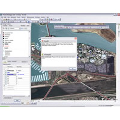
Esri Production Mapping
Esri Production Mapping helps organizations that produce authoritative geospatial content achieve economies of scale by managing and publishing accurate GIS data and cartographic products with fewer resources. With Esri Production Mapping, you can provide a shared work environment for teams of any size to improve the quality and value of geospatial data and cartographic products through standardization, repeatability, and configuration of your production processes.
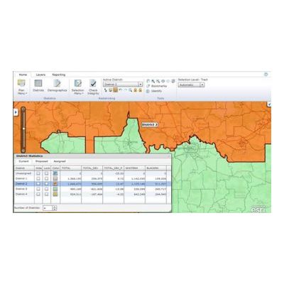
Esri Redistricting
Esri Redistricting is a Web-based solution for state and local governments, legislators, and advocacy groups to create political and geographic redistricting plans. With Esri Redistricting, you have the ability to address common needs and challenges related to redistricting at the state and local level.
Esri Roads and Highways
Manage Your Road Network; Integrate data from multiple linear referencing system (LRS) networks to get a comprehensive view of your roadways.